+ #Silenti, Ancient Sacred Sites, Christianity and modern mysticism, Consciousness, mystical travel, Photography
Two journeys, one destination (6) : a Pictish horizon
by Steve Tanham

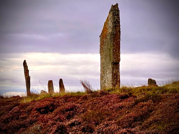
With the wonderful Portmahomack behind us, it was time to meet the three Pictish stones that marked the horizon line of the Tarbat Peninsula. These would originally have been visible from the sea, and boats approaching from the Moray Firth would have known they were approaching sacred Pictish land – centred on the monastery at Portmahomack.
On this second day of the Silent Eye’s Pictish Trail weekend, our plan was to work our way back from Portmahomack along the spine of the Tarbat Peninsula towards Inverness, viewing each of the major standing stones and ending with a visit to Rosemarkie – across the Cromarty Firth on the Black Isle.
Our first stop was at Balintore, a village that looks out over the Moray Firth. There, we saw signs for the nearby Hilton of Cadboll Pictish stone. I was eager to see this famous stone, about which we had read so much in the Tarbat Discovery Centre. I knew a little of its history, but the truth was to be more fascinating than I could have envisaged…

This Pictish stone at Hilton Cadboll was created at the Portmahomack Monastery to the classic design of a what we now call a Pictish Class II cross-slab. One side would have contained symbols from the older Celtic (pre-Christian) religion, mixed with local glyphs of the sponsoring family. The other would contain Christian iconography.
The cross-slab was erected here in about AD 800. Sadly, it broke soon after, under the pressure of high winds. The stone was re-erected, on the same spot; the lower portion being buried to form a new base. It broke again in 1674, and a further section was left in the ground. This beautiful stone has not enjoyed a happy history…
In about 1676 the entire Christian cross-face was chipped off by a local laird to create a family grave slab! By 1780 the surviving half of the stone was recorded as being near the ruins of a now-vanished chapel which is presumed to be located under the mound of earth next to the present stone.

(Above: the mound that covers the ancient church and, possibly its hamlet)
100 years later the stone endured a somewhat ‘political’ journey via Invergordon Castle and the British Museum to be returned to the National Museum of Scotland in Edinburgh, where the original is now located.
The local people were not happy at the loss of their precious stone, but accepted that it was now safe from harm and, at least, back in Scotland. Its original base and thousands of broken fragments were extracted from the site in 2001. But the local population were so supportive of their folk-history, they paid for a magnificent replica to be carved, in situ, over a five year period. The work was carried out by local sculptor Barry Grove.

(Above: the seaward-facing side of the Hilton Cadboll slab-cross. This was re-created by the sculptor using his knowledge of similar stones)
Barry says of the reconstructed stone:
“No Pictish tools survive. At our Iron Age bonecarving workshop, Jim Glazzard used a Viking tool box as his basis for the iron tools. The Hilton of Cadboll stone also provided some evidence. It snapped and blew over several centuries ago, and the remains of the base and lower areas of carving became buried.”
Remarkably, during an excavation taking place prior to the erection of Barry Grove’s replica, the original base (from AD 800) was found preserved by the soil – which also revealed the nature of the Pictish carver’s chisel marks. This provided the sculptor with a basis of authentic design and technique for the reconstruction of the missing cross face. Using what he had as clues, Barry Groves spent a month on the design, then began what would be five years of stone carving. The rediscovered original base has a secure home in the local Seaboard Memorial Hall in Balintore. Sadly, we didn’t have time to visit.
It’s a remarkable story of a small community succeeding against the odds…

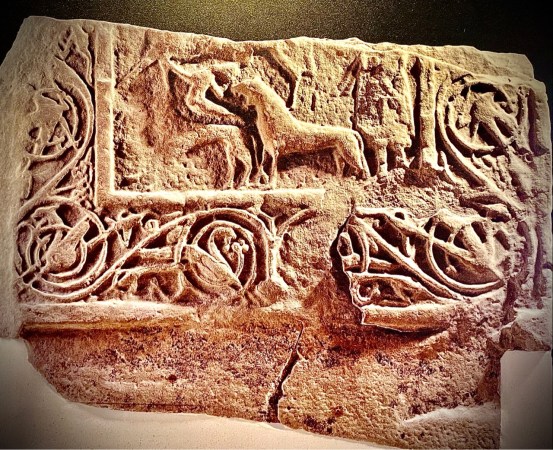
(Above: the upper face of the ‘Celtic’ Pictish design, showing a noble woman leading a hunt, which includes several men in the group on foot. This is deemed to show her superiority. She may well have been the sponsor of the Hilton of Cadboll stone. Above the hunt scene, the upper face contains the traditional twin discs and ‘V-Rod’ design, which will be commented on later in the post.
Standing before the ‘restored’ Hilton Cadboll cross-slab is a profound experience. You can view the stone as original Pictish ancestors would have seen it over 800 years ago. Standing in front of it in the sunshine, with the sea at your back, is quite an experience…and freely given. There is no charge.

It is believed that all such stones were originally painted. The image below shows how the centre section of the Hilton Cadboll cross slab would have originally looked. The use of colour makes the symbols a lot more ‘familiar’.

But what of the Pictish symbols, such as the ‘V-Rod’ and the twin discs, both of which feature on the Hilton of Cadboll stone? It is unlikely that we will ever find a ‘Rosetta stone’ that gives a word for word translation. But there’s nothing stopping us looking at the symbols and letting our conscious (and possibly subconscious) minds having a go…
Symbols are universal. If they ‘speak’ to us, then there’s a reason. We can relax and let them share what they are. We don’t have to be archeologists to sit with the symbol and let it talk. If we take a child’s approach and ‘say what we see’, then insights can happen.

Take the upper symbol above – the V-Rod. When I did this, earlier, the two halves of the rod suggested an arrow. But it’s not broken in two, just bent… at what looks like a precise angle; a little greater than 90 degrees. Lets take a guess and examine what 100 degrees looks like:

That looks quite close… So, as fingers have been around for a long time, and the Picts clearly had a strong grasp of numbers and geometry, we could say that the V-Rod might represent 10×10 fingers – or ten ‘men’. The arrow may indicate that they were warriors, so we have ten warriors, which may have had symbolic significance. It might have been short form for an army, for example.
The crescent looks moon-like to me, but it might also present the bowl of the heavens. Also, it seems to contain waves. This might alter the overall interpretation of the symbol. Also, the lower curves in the crescent remind me of the bowed shape of a sail. We might be looking at sailing warriors, then. Masters of the craft of sailing long distances, possibly using the moon or stars for stealthy navigation? Or perhaps the moon is simply a symbol for the sea, with which it is intimately connected?
I’d better go no further with this, as I seem to be making a good case for one of the leading families being Viking!
My specifics may all be baseless, but it’s the kind of open-minded approach that can bring novel insights. But we should move on… We had a timed entry at the museum in Rosemarkie, due to Covid restrictions, and we’d yet to visit Shandwick and Nigg.
The Hilton Cadboll stone is a dream to photograph…unlike our next location; which is a classic example of an intact Pictish cross-slab that has stood in its original position for over a thousand years…

To be continued…
Other posts in this series:
Part One, Part Two, Part Three, Part Four, Part Five. This is Part Six
©Stephen Tanham, 2020.
Stephen Tanham is a Director of the Silent Eye School of Consciousness, a not-for-profit teaching school of modern mysticism that helps people find a personal path to a deeper place within their internal and external lives.
The Silent Eye provides home-based, practical courses which are low-cost and personally supervised. The course materials and corresponding supervision are provided month by month without further commitment.
Share this:

+ #Silenti, Ancient Landscapes, Ancient Sacred Sites, myths and spirituality, Photography, Silent Eye School, Vikings
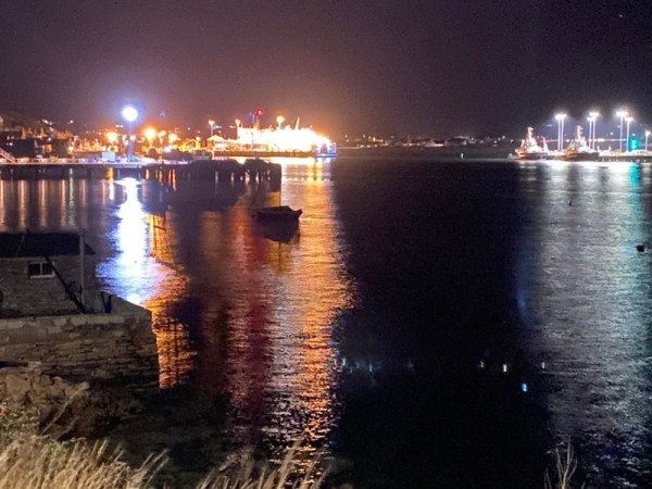
Stromness by night
by Steve Tanham
A series of short ‘betweens’ from the Silent Eye’s ‘Pictish Trail’ and ‘Ancient Orkney’ workshops.

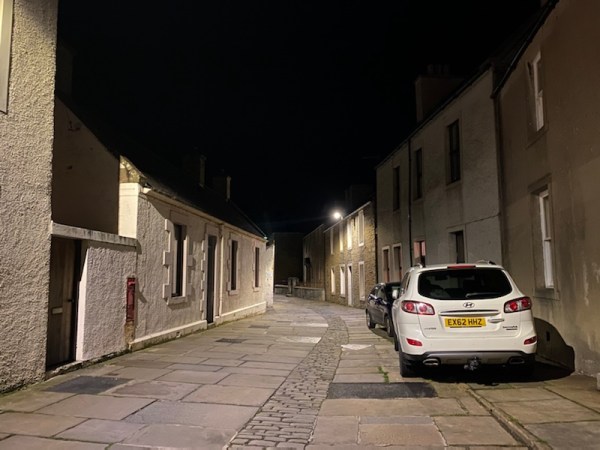
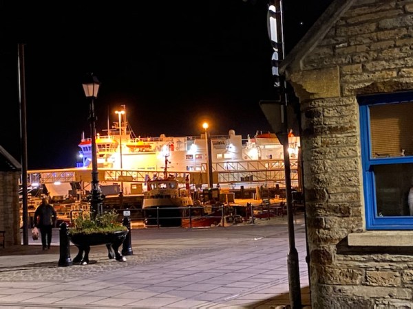
We’re having an after dinner walk along the night streets of Stromness, Orkney’s main ferry port and link with Scotland. My wife and I have stayed here once before. The ‘Ancient Orkney’ part of this Silent Eye trip has been so packed with exploring that this may be our only chance to wander along this fondly-remembered, but slightly deadly, ‘main’ road. Most of the shops are here, too; somehow squeezed and slotted into the irregular and curving stone contours.
I agree; it doesn’t look like a highway, but it is…
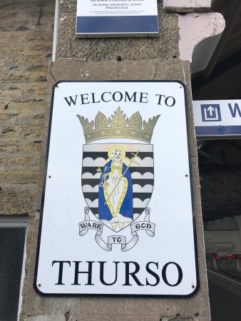
Orkney is an archipelago of islands, some connected by bridges, others by ferries of various sizes. Stromness is the main port for the west of the ‘Mainland’, as the largest island is called, and welcomes the majority of foot and car passengers coming to Orkney from Thurso’s port Scrabster, at the north-eastern tip of Scotland.
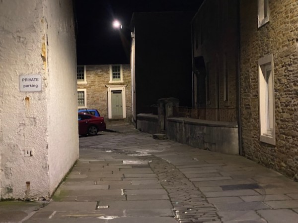
The historic main street is an organic and historic lane that curls and winds just behind the entire length of the seafront. It’s not even one-way, so vehicles and pedestrians are often to be seen doing a well- practiced dance of mutual avoidance…

It’s etched into the town’s history, and I suspect a badge of local pride, that, in 1814, Sir Walter Scott complained that the town couldn’t be navigated with a horse and cart because of the many steps built into the main street. The steps have gone, but were you to visit Stromness on a quiet day, you might feel that little else has changed….
Stromness is the most ‘different’ place I’ve ever been to. This main street (under no less than five different names) stretches for over a mile along the shore of Hamnavoe, an inlet of Scapa Flow protected by the islands of Outer Holm and Inner Holm. Scapa Flow was famously the home of the British Naval Fleet during the two major wars of the last century and has seen triumph and disaster.
The main thoroughfare, under whatever name you’ve reached on your stroll, is criss-crossed by smaller streets, lanes and passageways that on one side climb steeply up Brinkies Brae, the 300ft granite ridge that lies above the town, and on the seaward side, lead between close-packed buildings to the private wharves and docks that seem to lie behind every dwelling.
(Above: the view back to the port is never far away. Detour down any alley and you’ll find it!)
But the historical significance of Stromness does not rely solely on times of war. It featured strongly in the exploration of the northern seas, the Arctic and the relentless search for the Northwest Passage; the sought-after link between the Atlantic and Pacific oceans. For centuries, ships heading north had made Stromness their final supply point before braving the increasingly icy waters beyond.
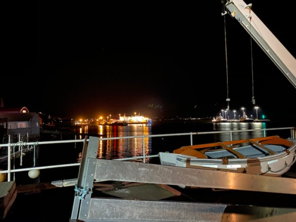
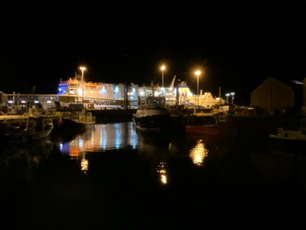
(Above) The main street finally emerges into a small water-side park area from which you can look back and see the whole of the port. We turned round, here. It had been a long day, and we needed to have an early start for what would be the final full day of the Orkney trip.
Returning the way we came, we emerged opposite the main dock of the ferry port from which we would, later in the week, sail back to Thurso on the Scottish mainland.
The town square opposite the main ferry dock (above) is home to one of Orkney’s proudest monuments – that of the explorer Dr John Rae. We were nearly back at our hotel, but stopped to review the story of this local hero.

(Above: Dr John Rae 1846-1854, Artic explorer. Portrayed in native Canadian Inuit dress)
Dr John Rae was born to a prosperous family on the Orkney island of Orphir. He became a respected surgeon and accepted an offer to accompany expeditions of the Hudson’s Bay Company, learning from the native people how to survive in the Canadian Arctic. He led three of the four expeditions in which he took part, travelling an astonishing 3,645 miles on foot and 6,700 miles by boat while tracing 1,765 miles of unknown Arctic coastline.
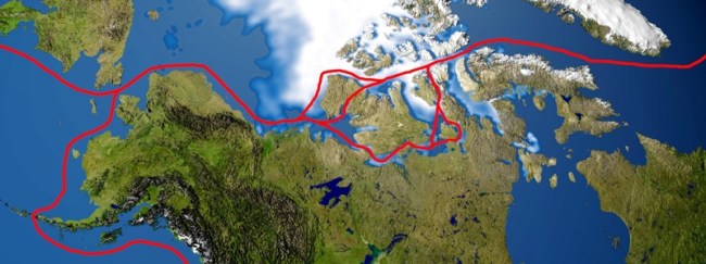
(Above: the routes of the Northwest Passage through the Canadian Arctic)
In 1854, he discovered Rae Strait, the last link in the first navigable Northwest Passage between the Atlantic and Pacific Oceans. Sadly, Rae’s reputation was damaged when, having examined the skeletons of the ill-fated Franklin expedition, in which all had perished, he pronounced, correctly, that the starving officers had resorted to cannibalism of the dead in order to try to survive.
The comments, though subsequently proved to be true, were vilified in the press and within the Admiralty. Franklin’s widow encouraged Charles Dickens to write about the conditions faced by Franklin’s crew in a way that scorned Dr Rae’s accurate findings.
Dr Rae was also disliked because he learned many of his survival techniques from the native Inuit people, with whom he mixed extensively. Despite discovering the final part of the Northwest Passage, Rae was never honoured with the usual recognition: a knighthood. Yet two of the senior officers of the failed Franklin expedition were posthumously knighted…
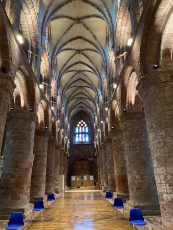
Dr John Rae’s reputation has been slowly reinstated by a determined local group on Orkney. His body is buried and honoured in the magnificent St. Magnus’ Cathedral in Kirkwall, Orkney’s capital.
St Magnus’s Cathedral was originally a Viking Christian building. The monument was unveiled on the 200th anniversary of Dr Rae’s birth.
Stromness is a pleasant and unassuming town. You wouldn’t think that it is a mere ten minutes by car from what was once the centre of a Neolithic civilisation with monuments more important than Stonehenge. The details of this will be covered in the normal sequence on the Silent Eye website: http://www.thesilenteye.co.uk as posts entitled ‘Two journeys, one destination’.
©️Stephen Tanham, 2020.
Stephen Tanham is a Director of the Silent Eye, a distance-learning organisation that offers a three-year journey of deepening the personality and aligning it with the soul.
Share this:

+ #Silenti, Lake District, landscapes, Mystery Schools, myths and spirituality, nature, Photographic techniques, Photography
Mellow moods for Autumn (2) The Secret Path
by Steve Tanham
There are three ways back from the centre of Kirkby Lonsdale to Devil’s Bridge, where most visitors park their cars, if they’re just there for the views and, possibly, a coffee.
There’s the river path, itself, with the steep descent down Mill Brow to the Lune Valley; there’s the main street out of the town to the south; and there’s this – the tree-lined path that takes a while to find if you’re new to the town. It’s an ancient way, and cuts right through the town centre, running, unseen, behind the main street until it reaches St. Mary’s Church.
It’s long, mysterious and quite wonderful. And, halfway down its gradual slope, there’s this tree…
©Stephen Tanham, 2020.
Stephen Tanham is a Director of the Silent Eye, a distance-learning school for the deepening of the personality and its alignment with the soul.
Share this:

+ #Silenti, Ancient Sacred Sites, Christianity and modern mysticism, Consciousness, mystical travel, Photography
Two journeys, one destination (5) : blood and stone
by Steve Tanham

Writing without the other hand to steady him was hard, but the other was clamped on his thigh, holding back the flow of blood.
The words on the vellum were like the wanderings of a dying bird… he smiled at the thought, despite the pain. Through eyes filled with hot and salty water he read what he had written:
‘They came at the end of the night, as the first light of day was seeping into the darkness. Four longships, sixty men or so… the smoke woke us, then the screams, then the stench of blood. When my fellow monks were lined up to face their deaths, the Norsemen began breaking the holy stones.
‘They are all dead, now. Somehow we escaped, half alive, into the vellum hut; just the master, Patternex, and me. “Write that the talking stones are still here,” my master commanded. “They are scattered but can be reformed..” He did not speak again, but I felt I could still hear his voice. His apprentice gazes at him with love, now, soon to follow him into the quietness.
‘Do not fear death,’ he taught me. ‘For what gives life brings death, and that brings life, again.’ He’d drawn a strange double curl in the sand, and pointed at the place in the middle where the lines crossed, saying, ‘When you die, you are here.’ His finger had slid sideways then, into the fullness of the other space… wordless, like now.
I have written on this vellum tablet what he… or his spirit, commanded. The red water of life seeps through my fingers and drips down through the timbers of the still-smoking hut. I hope it reaches the sea… ‘It is important that you wrote it,’ he said. ‘It may never be read, but it is of importance that it was written…’
No one knows exactly when the Vikings came to Portmahomack – sometime after AD 800 is the likely date. Skirmishes were frequent, but the final one seems to have been planned to destroy the monastery. The Norsemen did not like the survival of other people’s sacred traditions… Perhaps they feared them? It is ironic, because, having established their new kingdom on the archipelago of Orkney and in the extreme north of the Scottish mainland, they went on to embrace Christianity…
We will meet the Norse Earls of Orkney, soon. But for today, the Silent Eye’s group are studying the restored treasures of what their Norse forebears smashed, as we wander around the artefacts of the Tarbat Discovery Centre, during the last half-hour of our time-restricted visit, due to Covid regulations.
Smashed and scattered…. But the workings of intelligence, and particularly high art, have a habit of being found… It was always known, by the local folk of Portmahomack, that small fragments of carved stones often appeared during ploughing. But then the team from York University arrived, and spent the next few years carefully removing the layers of time, and cataloguing what they they found. There were no surviving large single cross-slabs at Portmahomack, but the excavations produced many fragments of smaller crosses and gravestones, all belonging to Pictish times.

(Above: a large slab grave stone from one of the monastery’s important graves. Above it is the Dragon Stone, found lying next to a wall in the excavated crypt. Below: Some of the important fragments from the monastery’s ancient past.)


(Above: Portmahomack, the regional centre for stone working, did have its own Pictish cross slab, but it was destroyed by Vikings. Only this lower fragment remains…)
The sculptures that stood on the Tarbert Peninsula in the eighth century are amongst the most accomplished anywhere in early mediaeval Europe. The centre of carving was at Portmahomack, where a dozen different monuments were made from the local sandstone. Many were simple grave markers carrying a cross. One was the lid of a great sarcophagus; likely the tomb of an eminent person. The most spectacular were giant cross-slabs set as markers for seafarers along the spine of the Tarbat and Fearn peninsulas. These were to be our next port of call after Portmahomack.
The cross slab design, type II, was known as the Cross of Christ, it followed a similar pattern on all such Pictish carved slabs. After Portmahomack, we planned to see two of these crosses – at Shandwick and Nigg. If time allowed there might be three…

Above is the Discovery Centre’s large photograph of the Nigg Cross – one of the most important on the coast and a classic of the Cross of Christ type II – Christian cross on one side, and local (and more ancient) symbols on the reverse. Later, I was to give thanks to the impulse that made me photograph it…

(Above: a classic Pictish ‘Z-Rod’ design)

(Above: the grave of an important chieftain was found beneath the crypt. This is a reconstruction!)
There were also at least four monumental crosses which once stood by the early church and at the edge of the monks’ cemetery. A further cross had a dragon on one side and the four apostles on the other – a recurring motif for the later Picts.

(Above: a classic Pictish ‘V-Rod’ design)
Large pieces of these Viking-smashed crosses were built into the foundations of the mediaeval church. Without the York University excavation work, they would never have been re-assembled. The fragments were found scattered over the burnt out rooms of the vellum working area.

(Above: the next stage of our journey mapped out in Pictish symbols – from Portmahomack to Shandwick, then on to Nigg and the Cromarty Firth)
The mysterious symbols, unique to the Picts, may well have represented holy men, warrior chiefs or powerful families associated with the settlements at Portmahomack, Hilton of Cadboll, Shandwick and Nigg. We may never know their real meaning…

(Above: the Pictish Comb and Mirror glyph – a female symbol)
There were almost certainly other ministries founded from Portmahomack in the proximity to the Moray Firth – the Picts’ stronghold. The nearest neighbours lay at Edderton, Rosemarkie and across the Forth of Moray at Burghead. All these have remarkable stone carvings which can still be seen today.
We cannot end the story of our visit to Portmahomack without mentioning two final exhibits: the beautiful metalwork section; and the finding of the ‘Oldest Pict’.

(Above: Sacred vessels and precious jewellery)
During the 7th to 9th centuries A.D. royal residences and ministries, such as Portmahomack, were centres for the production of bronze, silver and gold objects. Here, skilled metal workers created some of the finest treasures ever found in Britain and Ireland.
In order to celebrate the rites of the church, special objects were (and are) required. These included sacred vessels for the Eucharist – for example the chalice for the wine. The manufacture of these required great individual skill, given the simple forging methods of the time. The monastery at Portmahomack was one of the most important metalworking centres in the whole of northern Scotland.

Objects made of precious metals were a mark of status and success. The photo above shows elaborate brooches for use as treasured possessions of the Pictish wealthy.
Sadly, nothing produced by the monastery’s foundry survives. The examples here were made in Celtic Ireland during the same period, and are known to be faithful replicas of common styles across Insular (Irish) and Pictish lands.
We had seen so much, already, and it was only mid-morning…
The group took a break for a coffee and we reflected that there were two regrets. The first was the desire to ‘touch’ the Pictish civilisation in a deeper way – to feel some shared human connection with these civilised and sophisticated forbears. The second was to know the basis of their beautiful, symmetric artwork; to be able to see into the ‘mathematical mind’ of the Picts and see how they conceived and drafted their intricate designs.
Of course there’s no way to meet someone from the 7th century AD..
Or is there? I’m not talking fantasy; flesh, blood and bone do not survive alive… But the bones remain…

The west coast of the Portahomack Peninsula looks out over a vast, sheltered bay towards Dornoch. It’s a peaceful spot, and back in Pictish times, the ridge down the spine of the peninsula was a popular place to be buried. Many of these graves lie within the present village of Portmahomack, and several have been the subject of a careful excavation. The Discovery Centre has a fascinating section on ‘Our Earliest Pict’.

He was found in in a group of three graves. A lot is known about him from scientific analysis. The Discovery Centre has been able to use expert help to reconstruct, from his skeleton, how he would have looked, and what kind of life he led.
The grave was topped by a large slab of sandstone. The sides of the grave were lined with eight upright slabs, three to each side and one each at the head and feet. Within these lay the skeleton, on his back with his feet to the south-east. His arms were aligned along the sides of the body, the right-hand lay palm down, the left palm up, slightly cupped with the thumb across the palm. His legs were crossed at the feet. His head lay turned towards the south, the place where the sun was strongest.
The relaxed position suggests that the burial party laid him out carefully, but without a shroud. The method of laying down may have been a part of their pre-Christian religion. The head facing the sun suggests this.
Forensic work on the bones shows he was a youngish man, between 26 and 35, and stood 5’ 7” tall. Radio-carbon dating indicates he died between 420-610 AD, making him the earliest known member of Portmahomack’s Pictish community.
He was not born locally, and arrived here in his late teens. His life was physically hard, and placed his back and shoulders under heavy strain. He may have been a sword-wielding warrior or have worked with heavy rocks. He could have been a stone craftsman.
At the time of his death he suffered from arthritis and damage to the knees – probably through constant squatting, which is how you would have sat when there were no chairs and the environment was damp. He was left-handed, which would have made him much in demand for complex tasks. He was part of a settlement that ate beef, but also grew a variety of cereals: wheat, barley, oats and rye.

(Above: The face of Portmahomack’s first Pict emerges…)

(Above: And how he is likely to have looked..)
He belonged to the first community at Portmahomack, and may not have been a monk. The group of graves contained the metallic remains of intricate iron pins and a beautifully decorated roundel. They were horseriders who ate well and had high status. Although not necessarily Christian they were people of faith. Their major cultural investment was the making of these massive slab-sided graves, so they believed in an afterlife. Only in the next generation did they become spiritual professionals, the first monks of the Portmahomack monastery.
As we were leaving the Tarbat Discovery Centre, we examined the museum’s section on the Tarbat Ness Lighthouse, which has copies of Stevenson’s (as in the lighthouse builders, not the railway engineer) original plans for constructing the lighthouse, and a gallery of interesting astronomical photographs taken by local astronomer Denis Buczynski.
The Stevenson Lighthouse is located at the North West tip of the Tarbat Ness peninsula. It was built in 1830 by Robert Stevenson and has an elevation of 53 metres; with 203 steps to the top of the tower. It was too close not to visit. Back in July 2017, I wrote a detailed post about a Scottish visit to another of this famous engineer’s lighthouses.
We bought some books from the store and said our goodbyes to Margaret, the manager of the centre. Twenty minutes later, after a short car drive, we were standing near to the lighthouse and taking photographs. We only had time for the briefest of visits. If we were to stick to the day’s plans – and there was a lot of it left – we needed to be on our way.


The road along the spine of the peninsula returned us to Portmahomack. As we turned to leave the village, we caught site of the Discovery Centre’s manager, Margaret, walking along the road with a young man’s arm in hers. We stopped to wind the window down and give a final greeting…and to say how much we had enjoyed our visit.
We noticed her companion’s bright eyes upon us… He was smiling with pride.
Robert, the ‘voice from the upper floor’ during our visit, turned out to be a Down’s syndrome young man, and his undoubted intelligence had been put to good use at the Discovery Centre as one of their best volunteers. It was now lunchtime, and Margaret was taking him for a well earned meal at the local cafe – the Centre being closed for an hour.
[The names of Margaret and Robert have been changed to protect their privacy.]
We waited as they walked off, arm in arm. It was one of the most touching scenes. Beyond anything we had glimpsed in the distant world of the Picts, this sense of presence and kindness left us with a golden feeling as we drove the few miles down the spine of the twin peninsulas towards Shandwick, Where, beneath protective glass, there stands one of the best Pictish cross slabs – intact and in all its glory.
To be continued…
Other posts in this series:
Part One, Part Two, Part Three, Part Four, This is Part Five
©Copyright Stephen Tanham
Stephen Tanham is a Director of the Silent Eye School of Consciousness, a not-for-profit teaching school of modern mysticism that helps people find a personal path to a deeper place within their internal and external lives.
The Silent Eye provides home-based, practical courses which are low-cost and personally supervised. The course materials and corresponding supervision are provided month by month without further commitment.
Steve’s personal blog, Sun in Gemini, is at stevetanham.wordpress.com.
Share this:

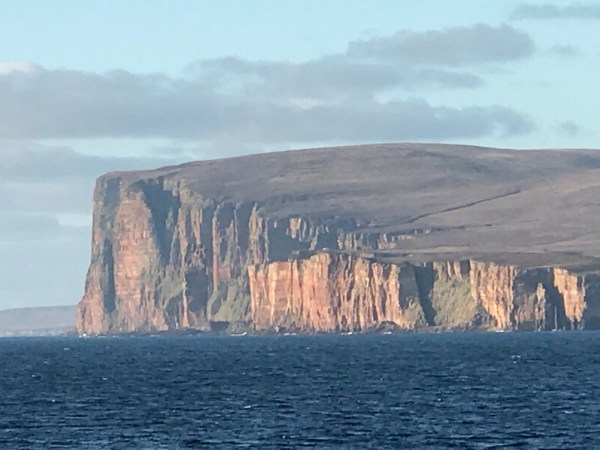
I remember the ferry poster. May 2018 and we were on our way to Orkney for the first time.
Four of us had travelled by ScotRail up from Glasgow to Thurso, a few miles west of John O’ Groats, the most northerly point on the British mainland.
From Thurso, we were booked onto the evening ferry to Orkney, landing in Stromness around ninety minutes later.
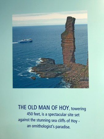
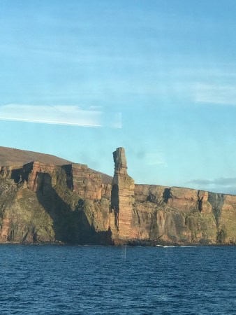
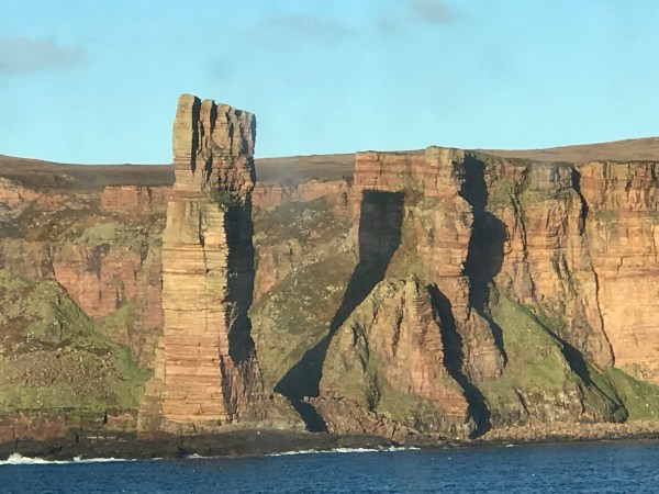
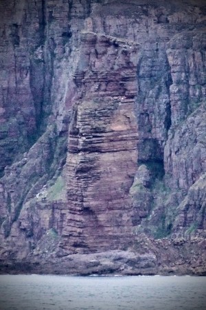
I saw the poster of the Old Man of Hoy just before we boarded the boat. It brought back the memory of a tense TV program in my childhood. This was in 1966, and before the days of widespread affordability of colour television. Looking back, the black and white pictures simply added to the death-defying drama, not that we knew any different.
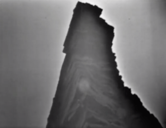
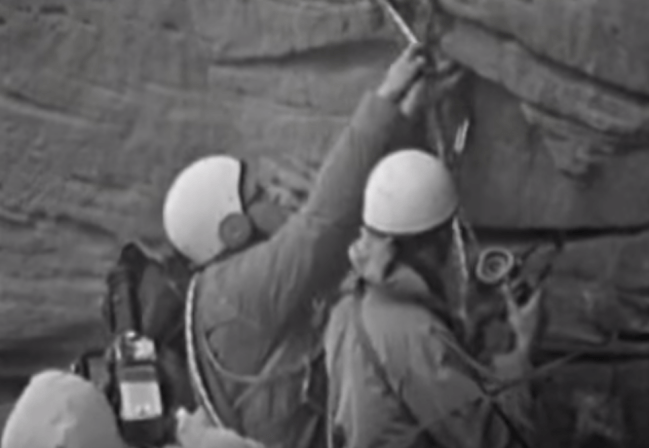
(Above: two images from the BBC’s programme The Great Climb)
Three British mountaineers, Chris Bonnington, Rusty Baillie and Tom Patey were attempting the first ever climb of a 500 foot sea-stack of rock located just off the Orkney island of Hoy. The sea-stack – a vertical section of rock that used to be part of a cliff face, but had weathered to form a separate peak – see poster – was being filmed from the adjacent cliff by a BBC outside broadcast team. 15 million people tuned in to watch The Great Climb, breathless and with ample tea and biscuits, as the three climbers made their slow ascent over three days.
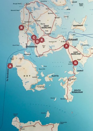
Ever since then, I’d wanted to actually see The Old Man of Hoy, but getting there is difficult, as it’s not even on the main island of Orkney. You have to take an inter-island ferry from Stromness to Hoy, then drive to the other end of the island and walk for two hours to get to the cliff-top that looks out at the Old Man… followed by the same journey in reverse. You’d need a car, and you might just do it in day.
However….
We had been told that the ferry from Thurso passed by The Old Man of Hoy on the way to Stromness – Point A on the ferry’s route, above. On a good evening, you could get a reasonable view from the deck of the boat, sufficient to take photographs – which was what I really wanted to do. On that occasion, we were lucky, and with nothing more than an iPhone, I managed to get the shots below:
Fast-forward to 2020, and the second journey in our Silent Eye workshop. We had concluded our ‘Pictish Trail’ weekend and headed up to Thurso, with a two-hour stop at Dubrobin Castle. You can read the posts of the Pictish Trail weekend here, its story is being told in parallel to these ‘out-takes’.
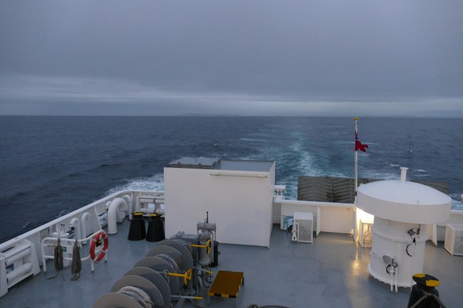
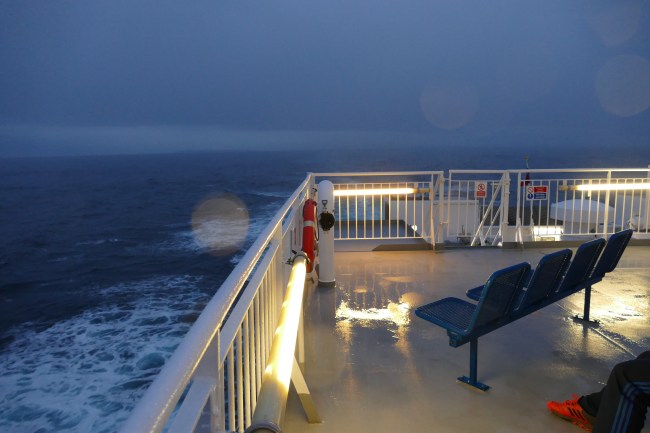
The picture sequence, above and below, tells the tale. When we left Thurso, the light was falling, but the weather was fine, and we hoped there would be enough to capture an image or two of the Old Man of Hoy. For this trip, knowing it might be my last chance to get a really good shot of the sea-stack, I had brought along a DLSR camera with a long lens. The chance of a good image of the Old Man was really the only reason I’d packed it, given that the new iPhones are so capable of dealing with the rest… at a fraction of the weight.
As we approached the time where the Old Man of Hoy should have been off the starboard bow, the weather took a distinct turn for the worse…

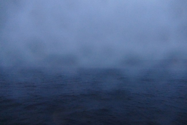

By the time we were alongside the The Old Man, I was the only idiot still on deck. I was soaked and my ‘good camera’ was inoperable… you just couldn’t see anything in the sodden viewfinder, especially as my glasses were sodden, too. Suddenly I felt decidedly old.
I considered abandoning the attempt, but decided to get my trusty iPhone out of its pocket and stand against the deck rail, staring miserably into the rain… just in case. I was already as wet as you could be.
Just then, there was a slight gap in the deluge and I managed to get the outline of the Old Man:
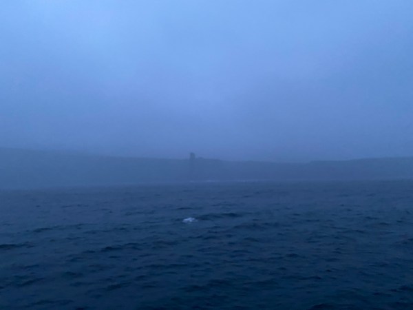
And that was it…
Life as a dedicated amateur photographer is like that… You take the rough with the smooth and give thanks when something wonderful happens.. which, clearly, wasn’t today!
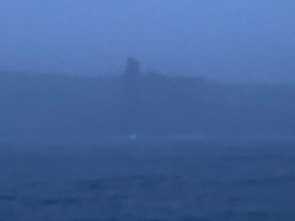
There was a return journey, of course, but, the light on that morning was ‘flat’, meaning it robbed the shots of any depth. Even edited, afterward, this was the best of the miserable bunch:
It was with some humour that I realised that the older photo, taken with my previous iPhone two years prior, was the best of the bunch.
You can follow the full story of the Pictish trail and the subsequent trip to Ancient Orkney on the Silent Eye , but here’s a couple of tasters…
Here are some of the posts from the Pictish Trail weekend:
Part One, Part Two, Part Three,
©Copyright Stephen Tanham, 2020.
Stephen Tanham is a Director of the Silent Eye, which offers a three-year, personally mentored, correspondence course in self-knowledge and a deeper understanding of how our sense of ‘self’ is built by life and can be turned to self-discovery of the individual soul.
Click here for more details…
Share this:

+ #Silenti, Consciousness, Lake District, landscapes, Photographic techniques, Photography, Seasons of the year
Mellow Moods for Autumn (1)
by Steve Tanham
A series of seasonal shots for Sunday, in either monochrome or with the colour reduced to give that mellow mood…
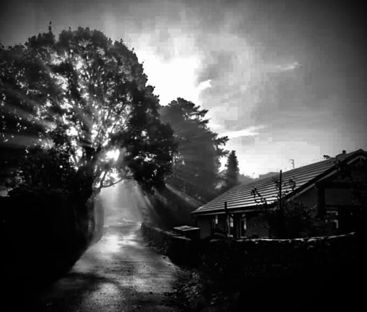
The mists and the lane.
The first mists gently fill the spaces between the trees at the end of the lane. So ‘soft and special’ you want to run out and take the shot before the shafts of sunlight disappear…
©Stephen Tanham, 2020.
Stephen Tanham is a Director of the Silent Eye, a distance-learning school for the deepening of the personality and its alignment with the soul.
Share this:

+ #Silenti, Ancient Landscapes, Ancient Sacred Sites, Christianity and modern mysticism, Consciousness, mystical travel, Photography
Two journeys, one destination (4) : two sides of the hill
by Steve Tanham

On the second day of the Silent Eye’s ‘Pictish Trail’ weekend, we are beginning in what is, for me, one of the most beautiful places in the world. Portmahomack is a small fishing village on the north side of the Tarbat Peninsula. It’s an hour’s drive north from Inverness.

I’m at the end of the pier, gazing out across the deep blue sea towards highland mountains in the distance. Low in the line of dense green forest and near the sandy line of that far shore is a white fairytale castle. It could be a dream but it’s not. It’s real, and we will be visiting it on our way to the archipelago of Orkney, tomorrow. It’s called Dunrobin Castle, and is the ancestral home of the Dukes of Sutherland.

The museum at Dunrobin has some fine Pictish stones, and the castle marks the most northerly point of the Pictish trail. But the real historic trail points further north to Orkney, and that is a very different land and one-time kingdom.
No-one in the group has been to Dunrobin, before. Having glimpsed its pale spires glinting in the morning sun, we can’t wait…but our Saturday has more than enough for now.
Today’s explorations begin with the sight of an ancient church just over the rise of the hill at my back. I can’t see it from here, but I can feel its presence. I want the others to feel it in a different way to how I first discovered it. I want them to feel its ancientness before they see it. To do this I have to enter a state which is crisp and clear with anticipation, then share it – without words.
It’s one of the things we do – Sue Stuart and I. There aren’t always words for how it works, in fact it’s more powerful when there are no words at all.
There are no words from either of them here, Because they are not with us. They are hundreds of miles south in a hospital, where Sue is being tested for something serious. Where there are usually three of the Silent Eye Directors on our ‘landscape’ weekends, here, there is one, and the workshop needs to continue. We have a duty to each other – and to those who have travelled so far.
I’ve held the emotions back so far, but here they are overwhelming. Sue loves beaches, and this is one of the best… So this is for her.

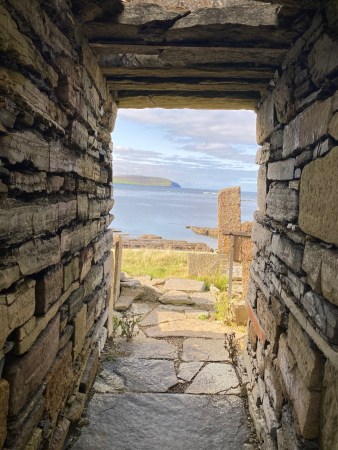
We return to our vehicles and I lead the way from the bay and over the small hill to the other side of the Tarbat peninsula. In front of us, at the entrance to what looks like an old church, is a striking statue of a Pictish Priestess.

We gather around her and I describe a visualisation in which we are approaching this place, not by car, but in a boat, cutting its way through the choppy blue sea as it nears the sixth-century harbour of the old Portmahomack.
As the boat turns to make its landing, we look up at the large stones that pattern the spine of the peninsula – and mark it as sacred ground… In our vision, we can see them all, though some are miles away.

These large marker stones will form the basis of the rest of the morning. They will lead down the Tarbat peninsula and across its sister; the Fearn Peninsula. By the time we have travelled their length, we will be at Nigg, from where we can look out south, across the waters of the Cromarty Firth towards the Black Isle, our afternoon destination.

The boat nears the shore. We can pick out the outlines of the harbour, a farm, and, at the highest point, a church. Ahead of us is an entire Pictish village on the shore. It’s a large settlement for this age. At its heart is a monastery as influential as the (Irish-derived) Celtic Christian monastery at Iona, and founded at much the same time. This is 6th century Portmahomack, and the monastery is one of a chain of such institutions tasked with nothing less than keeping civilisation alive… in the face of barbarism. This village houses the central spiritual authority of the Picts.
Here, there is also a metalworking foundry and scholarly building where sacred texts are painstakingly copied or created by hand, in all their ‘illuminated’ brilliance. These would rival the works produced at Lindisfarne, many miles south, though all will be lost to history – and the attacks of the Vikings… but the evidence will remain in their unmatched stonework.

Scriptoria is the scholarly name for the historical creation of holy texts. The map, above, shows the location of monasteries with scriptoria that existed at the same time as that at Portmahomack.

(Above: the tools of scriptoria. The writing instruments were found in the foundations of the church)
Each monastery would have had a library of books for copying by hand; the work carried out by a hierarchy of skilled artists and calligraphers. This was the ancient science of sacred communication – as vital to the Pictish people as the internet is to us. The holy books taught that mankind was both beast and something more. Sacred texts fed the higher.
Everyone spoke, few people read and wrote… when the writers spoke everyone listened.
The books were loaned and gifted by monasteries to each other. They travelled long distances and the art they contained came to have a great effect on sculpture and metalwork. Strong examples of this can be seen at nearby Nigg and Rosemarkie. We intend to visit both, today.

Aided by this vision of the landing of our ancient boat, our day begins here; around and within the white building ahead. This is the Tarbat Discovery Centre, and they are expecting us…
The Portmahomack Discovery Centre is one of the best places to ‘immerse’ yourself in the world of the Picts, their culture and their civilisation.


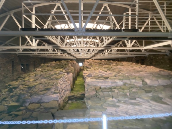
The Discovery Centre is unique in that the main subject of its work is itself. In a very real sense, the church remains a partly Pictish building. No less than six churches have stood on this site, and the earliest construction – part of a stone wall that still forms a side of the recovered crypt – is as it was constructed by the Pictish builders of the 9th century.

(Above: the Discovery Centre is housed in the old church of St Colman. Bishop Colman led the ‘Celtic Christian’ contingent, centred in Lindisfarne, during the Synod of Whitby in AD 664. Under the jurisdiction of the powerful Northumbrian King Oswiu, the church of Rome prevailed, steering Britain’s history away from the more mystically-inclined and nature-facing Celtic tradition that had travelled with St Columba from Ireland. Bishop Colman – St Colman – is remembered in the name of the old church, though there are no records to show if he spent time here, as he and his monks from Lindisfarne departed into exile… It is likely that here, as in Iona, Celtic Christianity continued for a while after)

You can plan a weekend workshop like this, and have it go mainly to plan, but the exceptions will often form the best bits. The lady who runs the Tarbat Centre is a Portmahomack local and very welcoming. We are lucky. It’s still early and we have the place to ourselves.
She is in the middle of explaining the layout when a rather wild shout comes from above: “Margaret, I’ve done it!”
She smiles. “That’s Robert, one of our best volunteers…” she leaves it there… but you know there’s more to the story, as we’ll find out later. After watching a short introductory video, we wander… and it’s amazing.

The upper floor is the education centre where talks are given. The centre owes its existence to the results of the major excavation carried out by York University between 1997 and 2004.

(Above: the archeological work at Portmahomack, carried out by York University during 1997-2004. St Colman’s church is top right)
The centre has three levels. The main, middle floor is divided into exhibition sections. The crypt – the lowest level – dates all the way back to medieval times. It has lots of history and two skeletons…

On our first pass around the centre, we concentrate on the societal aspects revealed by the Tarbat discoveries – the importance of the Portmahomack monastery to the lives of all the Pictish people. There is one important aspect of this to consider before we can progress to the archeological relics: the question of how central the monastery was to the economy of the region. Two information boards describe this well:
‘The Tarbat peninsula contains some of the most productive agricultural land in Britain, But when the monastery was founded in the 6th century CE, the landscape was very different. The valley behind the church was marshland, which has been radiocarbon dated to the 1st millennium BCE.
Several Neolithic and Bronze Age flint arrowheads have been found close to the area suggesting that wild fowl on the marsh attracted prehistoric hunters. This wild marshland was tamed by the monastic community of Portmahomack, who drained it to create grazing for cattle and plough lands for grain.
Vast quantities of animal bones have been found during excavation which show that plenty of pasture must have been available for grazing cattle and sheep. Pigs were also eaten and may have been let loose to forage for food nearby. More rarely, deer bones have been found which shows that the land surrounding the monastery was home to wild herds.
Crops were also cultivated and the first signs of this were visible in the earth as scratch marks made by a wooden plough. In order to toughen the board against wear and tear, it was studded with small pebbles known as ‘plough pebbles’. The pebbles sometimes fell out and many have been found during excavation. An ancient ditch found beneath the church dated to the 6th century, contained burnt grain identified as barley. A massive barn found in the farm area of the monastery would have been used to thresh, dry and store the barley following harvesting by hand using a sickle.
For centuries, grain was ground by hand, using either a trough quern or a rotary quern, but both methods were time-consuming and hard work, The 8th century monks introduced the horizontal water-powered mill, in which a fast moving stream turned the mill wheel, which turned a millstone.
The dam for a mill has been uncovered at Portmahomack, made of a massive retaining wall with a culvert feeding the mill race. The mill itself may lie under the modern road. Monasteries like Portmahomack eventually came to control grain processing and this was an important factor in controlling the size and economy of the local population.’
A very important ‘village’…
Now, Robert is shouting from the lecture room that he’s solved another of Margaret’s problems, and I’m wondering how I’m going to fit any more into a single blog… and suddenly everything goes quiet, outside and in, and I realise we don’t have to…
The Discovery Centre is too good to squash into a single post… so let’s give it two…
Besides, ahead of me at this point in the retelling is one of the most beautiful chalices I’ve ever seen… And I’m eager to fit it into our newly discovered cultural framework of the amazing Picts.
(Above: a beautiful and mysterious chalice awaits us…)
In the next post we will examine the legacy of the Pictish objects found within the excavated Portmahomack site, before moving on, down the spine of the peninsula, to a beautiful glass-protected cross-slab… and two surprises, one of which will test our ingenuity to the full!
To be continued…
Other posts in this series:
Part One, Part Two, Part Three, this is Part Four
©Copyright Stephen Tanham
Stephen Tanham is a Director of the Silent Eye School of Consciousness, a not-for-profit teaching school of modern mysticism that helps people find a personal path to a deeper place within their internal and external lives.
The Silent Eye provides home-based, practical courses which are low-cost and personally supervised. The course materials and corresponding supervision are provided month by month without further commitment.
Steve’s personal blog, Sun in Gemini, is at stevetanham.wordpress.com.
Share this:

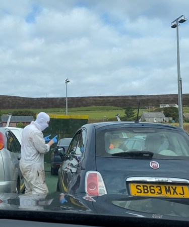
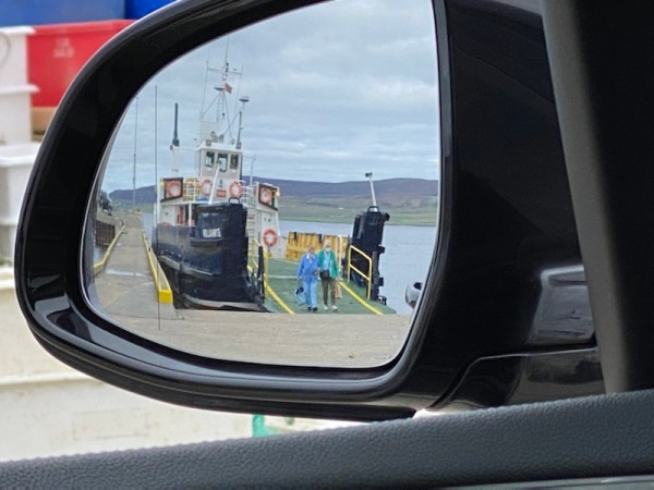
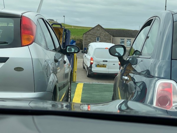
The sinister man in the white overall was tall and very athletic. He’d just talked me through what was going to happen next – punctuated by rapid movements of his blue gloved hands. I was still shocked and not sure I’d heard correctly, so in the photo I’m watching carefully as he explains things to the car ‘in front’. My one salvation was that I wasn’t to be the first car to attempt this treacherous descent… I would be the second…
The car in front is really the one behind, because we were all facing backwards to our normal direction of travel… We were doing that because we had to back our cars onto the small boat to allow for easier disembarkation.
The direction of travel was down the quayside to the edge of the loch. There was a boat there, obviously – the above shot was taken before it arrived. We were on the final day of the Silent Eye’s workshop in Orkney. The full story, in the correct sequence, is being told as the Thursday blogs on the Silent Eye website.
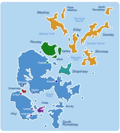
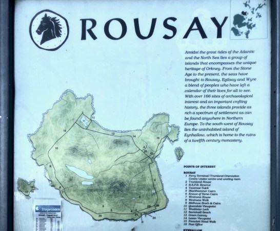
I must have missed that when we booked the tickets for our day trip to Rousay; one of the islands north of the Orkney ‘mainland’, shown in green on the ferry company’s map below. The ferry service is used mainly by locals – it’s their lifeline to the outside world.
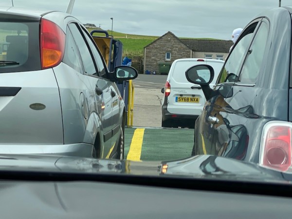
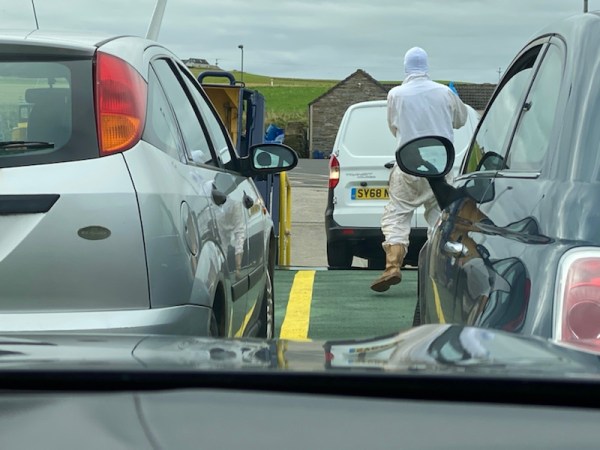
The ferry boat had arrived. It clunked to a violent and screechy stop on the concrete and didn’t appear to be fastened there by anything but gravity and friction. The ferry was behind me, of course, and the tall man in white with blue hands had taken up his position to ensure that all the departing foot passengers were off the boat.
I was watching all this in my rear view mirror and taking in large amounts of oxygen.
I stared as the car behind me literally disappeared into the gloom of the lower quayside… Then there was a bumping noise and it reappeared climbing backwards onto the boat, making it look simple. “He’s probably done it a thousand times,” I muttered…
I swallowed, noisily. It was my turn… The man with the blue hands was gesturing impatiently at this obvious tourist. I put the car’s auto into reverse and stared, not at the mirror, but at the larger sat-nav screen which doubles as a reversing camera. The view is wide-angle and, thankfully, very accurate – with projected green lines to show you’re on-target… or not. I felt the car tilt down at the back, but at this distance, because of the ‘fish-eye’ effect, I could see only an expanse of concrete. The boat was down there somewhere… All I could do was to aim for the middle until the ferry’s loading ramp came into view. I was conscious that, at this point, I could well have been driving backwards into the loch.
It’s shocking what doubts enter your mind at moments like this…
I can’t show you photos of my own descent… I was rather busy. The middle of the boat’s loading platform had appeared, mercifully, right in the middle of my green lines of safety. I pressed on, conscious that the man in white with blue hands was probably finding fault. No sooner had all four wheels clunked on board than he appeared in my lowered window, apparently less impressed than I was with my arrival on his vessel.
“I want you to stop looking at that fancy rear camera and watch my hands,” he said, exasperated. I’ve modified a couple of his spoken words... I realised he’d probably been gesturing with the blue hands for the past few minutes, while I studiously ignored him… Mmm…
Obediently, I watched him in the mirror as he gave highly precise arm movements – reversed, would you believe, to allow for the fact that he was in my mirror. He looked slightly mollified when I followed them, accurately, and we slid into place without fuss. Then he was off to the next car.
I could breathe again…
Shortly afterwards, he dashed along the loading ramp to rescue a driver who had panicked and refused to back down the quay any further. “It’s okay, I’ll drive it on for you,” he shouted, more warmly than with my rebuke. The driver and her elderly passenger got out and became grateful foot passengers. With the blue-handed sailor at the wheel, the recalcitrant car whizzed backwards to the place next to me… It was all over in about five seconds. I tried to suppress my admiration…
As the last of the cars loaded, I grabbed my camera and shot this sequence to illustrate the ordeal. We had to stay in the cars for the duration of the short crossing.
(Above: Loading backwards. It doesn’t look that close in your rear-view camera!)
(Above: Clunk onto the steel deck!)
(Left a bit!)

(And straighten up… Done!)
Apparently, I was quiet on the rest of the short voyage. Perhaps I was the only one who realised we had a return crossing at the end of our day…
Rousay is beautiful and completely unspoilt. For us, the high-point was a glimpse of civilisation two thousand years ago in the form of a defensive broch – a fortified dome of rock, common in Scotland’s ancient history and still largely intact after all this time.
For that, you’ll need to wait for the full story to unfold on the Silent Eye , but here’s a couple of tasters…
And the ferry people are excellent and will get you there, and back safely…
©Copyright Stephen Tanham, 2020.
Stephen Tanham is a Director of the Silent Eye, which offers a three-year, personally mentored, correspondence course in self-knowledge and a deeper understanding of how our sense of ‘self’ is built by life and can be deepened.
Click here for more details…
Share this:

From Sue…
As the majority of our friends and readers will now know, I was rushed into hospital last week in a very bad way. I would like to say a HUGE thank you to everyone who has sent good wishes through all the various social media platforms, through the comments, by email, snail mail, text and phone. And to the friends wh have kept me company across the miles with tales of normality and laughter.
I am sorry if it has taken a while to respond to everyone individually, I am really rather unwell and my energy levels are a tad variable.
At a time when the Covid restrictions mean that even close family cannot visit, it has meant a very great deal to be touched by so much love, friendship and kindness. Trying to process the changes that serious illness has and will impose upon us as individuals and as…
View original post 270 more words
Share this:


Tess: The sea is down here, I told you.
Human: but you don’t like swimming in the sea! you like running on beaches.
Tess: Where there’s a sea, there’s a beach!
Human: Well, we can’t go straight to the beach that way.
Tess: Why not, it’s quicker!
Human: Because it’s a railway line…
©Stephen Tanham, 2020.
Share this:

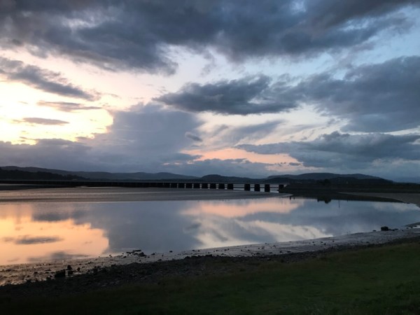
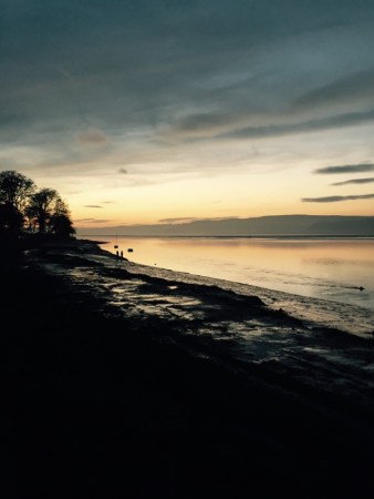
The coastal town of Arnside is famous for its sunsets. Two rivers; the Bela and the Kent, flow out into Morecambe Bay through the arches of the famous long viaduct that connects Arnside with Grange-over-Sands on the way to Barrow-in-Furness, famous for our nuclear submarines.
But this is a wet Monday, and Tess, our collie dog, is familiar with a different drill, as I drive to Arnside to find a place for her to chase her high-bouncing ball and give her enough exercise to last till the day after.
In contrast to the glorious sunsets, this Monday morning looks like this:
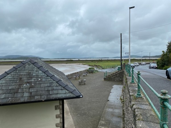
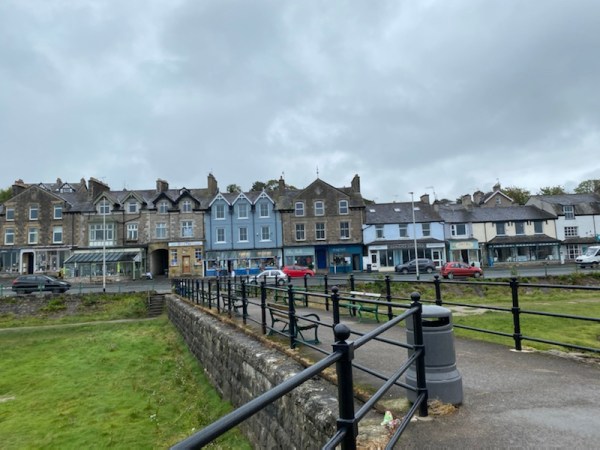
(Above: Arnside promenade: the hidden triangle of dog-perfect foreshore)
It’s another wet, Cumbrian Monday. The summer feels long-gone. The collie is bored and, as, statistically, I’m the primary dog-carer, I like to take her somewhere that will tick several boxes with the same amount of petrol.
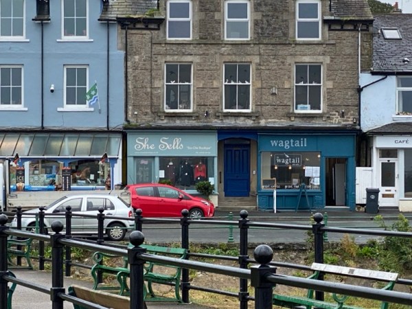
Tess knows the drill… That small patch of green in the photo above is a triangle of land just big enough to give her a substantial ‘chuck’, before the two of us head to one of the nearby cafes to collect a take-away coffee and a slice of cake, usually lemon drizzle cake, for which the Wagtail Cafe is justly famous. Due to Covid restrictions, the sit-down part of the cafe has been re-arranged into a flow diagram to route you in past the cake counter and till, then back out, again…
Equipped with coffee and cake, we retreat to the end of the small pier and huddle from the wind and rain. With coat, hat and hood keeping me dry, and the patient and (by now) well-chucked collie sitting beside me watching the hopeful pigeons. It’s straight out of one of Allan Bennet’s witty and wonderfully observed tales of human oddity.
Once fed and watered, we make our way back to the place where we respectively throw and chase the ball. The large triangle of level grass that forms the foreshore is hidden from the road at a lower level. You have to know it’s there. There’s a lot of sand around Morecambe bay and a much of it is quicksand and treacherous. But this small plateau is perfect for our purposes. Only the occasional high tide makes it unusable.
Tess gets a second round of exercise, then we get back in the car and meander gently home via Milnthorpe, a small town built at a crossroads where you can pretty much buy one of everything.
Drizzle Mondays, we call them. A pun on the combination of cake and rain. Sometimes, we think back to some of the great sunsets we’ve seen at Arnside… and it’s all worth it.
©Stephen Tanham, 2020
Stephen Tanham is a Director of the Silent Eye School of Consciousness.
Share this:

+ #Silenti, Ancient Landscapes, Ancient Sacred Sites, Christianity and modern mysticism, Consciousness, mystical travel, Photography
Two journeys, one destination (3) : the mystery of the Picts
by Steve Tanham

(Above: the view of the neighbouring Inverness Castle from the steps of the museum)
‘The Romans were frightened of them…”
I remember reading that the week before our Scottish workshop and being astonished. I knew the Picts had created some of the most mysterious stone carvings I had ever seen. But fearsome warriors? Weren’t these enigmatic people simply farmers?
We were in the Inverness Museum, which is one of the best places to study the history of the Scottish Highlands. Our interest was specific and restricted – though we could have happily been there half the day. We were there to gain a perspective on the story of the Picts’ existence: where they came from, how long they endured, the nature of their spirituality, and the location of their primary settlements.

(Above: the land of the Picts)
Equipped with this mental map, the following two days of our Silent Eye weekend would enable us to place in context some of the most remarkable pieces of Pictish stone carving and other artefacts, as we travelled, in turn, up the Tarbat peninsula, down to the Black Isle and, finally, to Dunrobin Castle on our way to the Orkney ferry at Thurso.

(Above: Cast of the Brodie Stone, a mystery in two halves:)
Following the Pictish Trail throws up some wonderful mysteries and instances of great fortune. As an example (above), the Brodie Stone, a classic ‘cross slab’ – a cross carved within a surrounding stone surface. The real Brodie Stone stands in the grounds of Brodie Castle, Moray. It was discovered in 1781 during the digging of foundations for a new parish church. For many years it stood in the village of Dyke as a tribute to Vice-Admiral Rodney, for his success at the battle of Saintes, in Dominica. Since then it has also been known as ‘Rodney’s Stone’. It is actually a Class II Pictish stone, meaning it has a Christian cross on one side and Pictish symbols on the other. The Picts converted to Christianity during the 6th and 7th centuries, as we explore, below.
We’d had to reserve our places for the museum online, as the Covid-19 restrictions applied. We were allowed to enter only in small groups and at our allotted time. We were also expected to maintain a steady flow through the exhibits to prevent queuing at the entrance. A tall order, when we had so much to absorb… But at least photographs were allowed, and many of the information panels featured graphical summaries without which this post would have had much less illustration. Sincere thanks are due to the Inverness Museum for allowing this.
Before us were information displays on the geographical and geological history of the region, showing Scotland’s organic formation after the last ice age:

(Above: after the ice; the emergence of Scotland at the end of the last ice age)
The last ice age ended in Scotland about 9,000 years ago. The melting ice gave way to tundra – an arctic diversity of mosses, lichen and grasses, supporting mountain hares, arctic foxes and reindeer.
As temperatures rose, the tundra was invaded by birch scrub and then woodland, Oak and scots pine eventually replaced the birch, and cloaked the Highlands in dense forest. This became home to red deer, elk and wild cattle.. along with wolves, bears, lynx and, humans.
Around 9000 years ago, the European hunter-gatherers, enabled by the melting ice-sheets, reached the Highlands, and, as conditions improved, they settled permanently to become the first highlanders. They were originally nomads, but, as stone gave way to bronze and then iron – the iron age, the Picts established their home and became skilled farmers.
Then we came to the first of the Pict-focussed panels.

(Above: one of the panels in the Inverness Museum places the Picts and Romans co-existing from 80-399 CE. Beyond this, the Picts survived to around 900 CE, when they ‘mysteriously vanished…’)
The Iron-Age people who became the Picts were inhabitants of this Highland coast long before they were given their name by the Romans, who called them the ‘Picti’ – painted people; the reference being to their custom of painting their naked bodies before they went into battle, thereby giving a ghostly sheen to their skin and showing off their warlike body art and battle scars. Despite this frightening appearance, they were essentially peaceful farmers, whose ferocity appears to have been roused only when they were threatened.

(Above: a picture of the Pictish Hilton of Cadboll stone. We had no idea that the weekend would bring us face to face with a large and exact life-size replica! Note the twin circles in the upper and middle parts; these are considered feminine and depict ‘comb and mirror’. The inset ‘V’ shape is another classic Pictish symbol called a ‘V-Rod’)
The Picts left no written record of their history. What we know of them comes from the striking images they carved in stone – which therefore endured. They were written about by both Scottish and Roman writers. The Roman Eumenius, in 297 CE, was the first to refer to them as Picts. There is an alternative theory of the name ‘Pict’, which refers to their own word ‘Pecht’, meaning ancestors. This link to those of their own who ‘went before yet still remain’ has strong spiritual overtones, as we shall see when we get to the Orkney part of these journals.
Recent evidence suggests that the Picts came to Scotland from Orkney, and before that were descendants of Scandinavia, though they lived much earlier than the Vikings, who, according to some sources, were to feature cruelly in their eventual demise. Orkney played a fundamental role in the advancing civilisation of what became Britain, and the age, sophistication and influence of its works is staggering. When we come to consider the spiritual beliefs of the Picts, Orkney takes on an entirely different importance…

(Above: Wolf Stone
Found at Stittenham, Andross, Ross & Cromart
This incised Pictish stone was found in 1903 built into an old wall. The graceful figures of the wolf is depicted using a few carved lines to give a sense of movement and shows the power of the animal)
The Picts lived here in the Highlands; the Romans invaded. With the Picts, they came up against something they didn’t understand…and came to fear. If the local forces were losing a battle, they would simply vaporise into the landscape – a wild landscape they knew well, unlike their oppressors. The Romans became frustrated, then despondent, at the failure of their traditional military tactics.
The Picts held their ground against the invaders in a number of engagements, but also lost major battles. It’s often said that they lost the battle but won the war. Scotland was never successfully conquered by the Romans, though they tried many times and succeeded in establishing forts well into the Highlands.

(Above: a Pictish picture of an ‘unknown beast’. Also found at Stittenham, Andross, Ross & Cromarty)
The Picts left no writing, unless their art contains a hidden phonetic key, awaiting the equivalent of the Rosetta Stone that enabled the translation of the ancient Egyptian hieroglyphs. Written records, by others and about the Picts exist from 297 CE until 900 CE, when they supposedly vanished. Scholars caution against interpreting this as extermination, since it is likely that they simply merged with the surrounding Scots tribes. It is also probable that the Picts’ adoption of Christianity in the 6th century CE was (at least in part) political.
The ‘Scots’ were, in those times, the rival tribe to the south. Further south, still, was Northumbria – one of the most powerful kingdoms in Europe. In 664 CE, Northumbria’s King Oswiu hosted the Synod of Whitby at which the rivalry of Celtic and Roman Christianity was determined in the Roman Church’s favour. By the time the Picts embraced Christianity, the Roman church had become the de-facto Christian faith across most of Europe. That the Picts came to embrace it is the logical act of a people who wished to live ‘in harmony’ with their neighbours. This may also explain the eventual merging of the Picts and the Scots, and the apparent disappearance of the former.
But what of their art? One of the main goals of the Silent Eye’s weekend was to consider its extraordinary clarity of design, its refreshing simplicity and the use of recurring motifs. The museum had little to say on this, so we hoped that our further journeys to the Tarbat peninsula and The Black Isle would help us. We had been successful, however, in placing the Pictish people, in understanding a little of their motives and culture. We had a framework within which to work. Inverness had served us well.

(Above: The Achavrail Armlet
The example of ‘massive metalworking’ reflects the designs adapted from continental Europe. Dating to the first or second centuries CE, this large bronze armlet was made by the ‘lost wax’ casting method)
Our time was up. The enforced flow around the exhibits had meant a rushed gathering of information. What we needed next was a degree of immersion in the Pictish culture. In the morning, a forty minute drive north from Inverness would see us enter the Tarbat Peninsula (see map). There, on one of Scotland’s most beautiful coasts, we would find a former church dedicated to a much deeper social understanding of the mysterious Picts.
But first, it was time to chill for an hour or two and then get ready for some much-needed pizza!

(Above: Mobile populations.. The Inverness museum illustrates many facets of Highland life. Silver pocket watches by Primus Mink and Faller brothers, 1870s. Mink and Faller brothers were craftsmen driven from Germany by political unrest during the late 1800s. They and at least six other German watchmakers flourished in Inverness at this time…)
To be continued…
Other parts of this series of blogs:
Part One, Part Two, this is Part Three
©Copyright Stephen Tanham
Stephen Tanham is a Director of the Silent Eye School of Consciousness, a not-for-profit teaching school of modern mysticism that helps people find a personal path to a deeper place within their internal and external lives.
The Silent Eye provides home-based, practical courses which are low-cost and personally supervised. The course materials and corresponding supervision are provided month by month without further commitment.
Steve’s personal blog, Sun in Gemini, is at stevetanham.wordpress.com.


")


You must be logged in to post a comment.