+ #Silent Eye, #Silenti, Consciousness, Lake District, landscapes, Photographic techniques, Photography
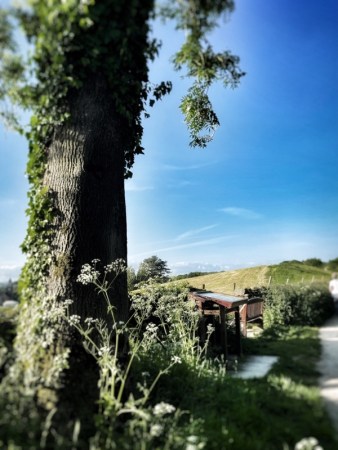
Where Seagulls Dare
by Steve Tanham
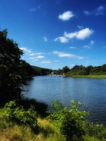
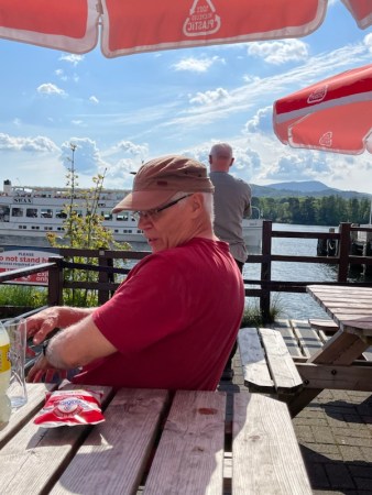
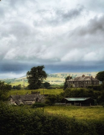
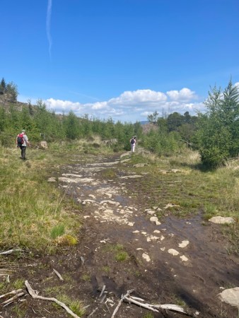
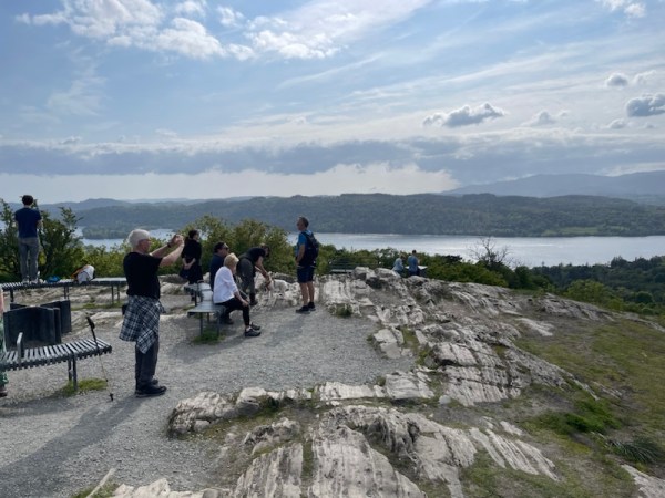
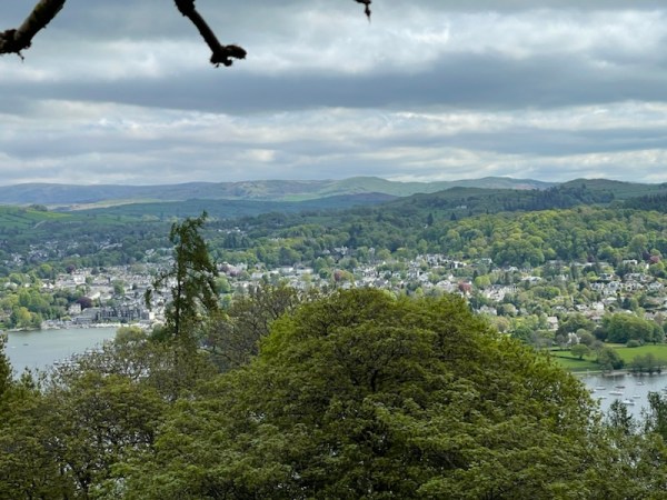
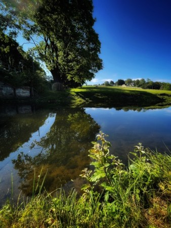
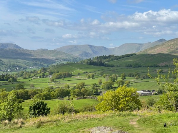
Didn’t know they were there until I was reviewing the photos later – the seagulls. A whole flock of them whirling overhead, back right of shot; unseen but brightly present…
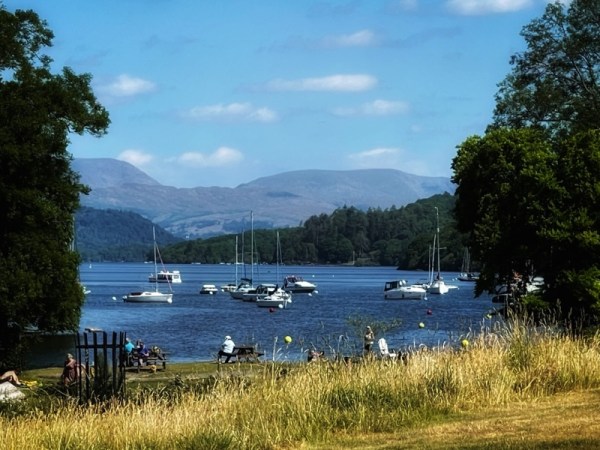
Fell Foot Park on the south-eastern tip of Windermere. It’s a National Trust estate with a delightful walk in a figure of eight that takes you away from the final basin of the lake and up the slope of a meadow.
When you emerge from the meadow and descend to the water’s edge, the lake has become a river and is busy narrowing itself to fit under the stones of Newby Bridge.
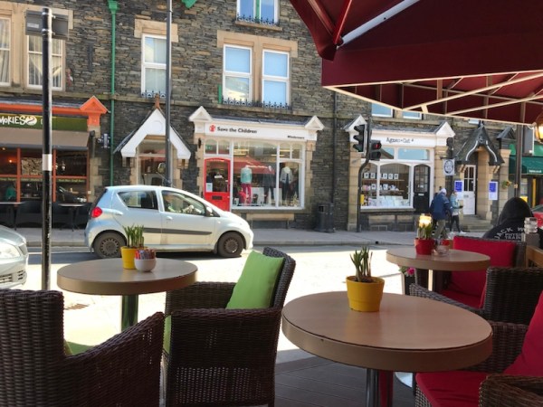
And a coffee back at the boathouse? Be churlish not to…
But the hidden seagulls made my day!
©Stephen Tanham 2023
Stephen Tanham is a Director of the Silent Eye, a journey through the forest of personality to the dawn of Being.
http://www.thesilenteye.co.uk and http://www.suningemini.blog
Share this:

+ #Silent Eye, #Silenti, Ancient Landscapes, Consciousness, Lake District, Photography, Silent Eye School, Spirituality
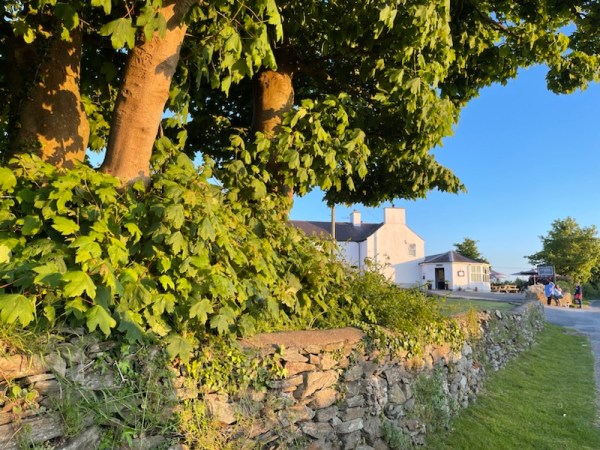
Water-Circle+Cross (5) The Wray home?
by Steve Tanham
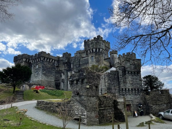
Wray Castle is an imposing neo-gothic building on the north-western shores of Lake Windermere. It’s not a real castle, but looks very much like one, and was crafted according to authentic historical plans. It was built in 1840 for a retired surgeon from Liverpool, James Dawson, who also commissioned Wray Church on the same estate.
He used his wealthy wife’s fortune to create it, and it was intended to become their main family residence… but she didn’t like it, so it was never occupied in the way he had intended.
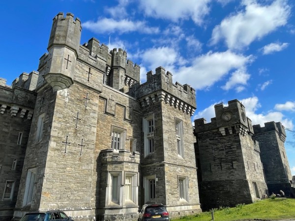
As can be seen from the pbotographs, It is an imposing creation, and we can admire Dawson’s vision… and sense his disappointment … and perhaps smile at life’s hubris-killing moments. We’ve all had them, but perhaps not on this scale…
But the story has a happy ending…
After Dawson’s death in 1875, the estate was inherited by his teenage nephew, Edward Preston Rawnsley, and later passed to Hardwicke Rawnsley, a cousin and clergyman who had a keen interest in protecting the countryside from the kind of rampant private development that was taking place on the other side of the lake.

Wray Castle has an association with another key player in history of the National Trust, Beatrix Potter, whose love of these parts began during a summer holiday in 1882, when she was 16. In 1905, she used the royalties from her first book, The Tales of Peter Rabbit, to buy the first of many farms nearby, though she never owned the Wray estate and its castle. On her death, the considerable estate she had amassed was passed to the National Trust, whose development she greatly assisted.
Hardwicke Rawnsley, who had become the vicar of Wray parish, was strongly influenced by the ideas of the respected social reformer, John Ruskin. He conceived of the idea of a ‘national trust’ that would buy land in the area and hold it in the public interest, preventing the sale of the assets to private developers – in perpetuity.
The house and grounds at Wray have belonged to the National Trust since 1929, and the house has been open to the public on a regular basis since 2013, though it performed other functions during the war years and after.
It is thanks to these people that the National Trust exists in the form it does today, though that perpetuity should never be taken for granted, as recent activity for the infiltration of the Trust by a conservative group based in London demonstrates.
Anyone standing in the beautiful upper gardens of Wray Castle in the afternoon of 20th May, 2023 would have seen a slightly weary group of walkers making their way – as quickly as their guide could provoke – along the lake path and completely bypassing the track up to the castle grounds, which, thankfully, had remained unseen…

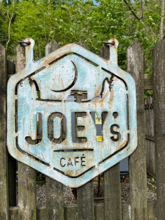
The unstated plan for our workshop group to have lunch at the other Joey’s (vegetarian) cafe – within the Wray Castle Building, had been abandoned by the organiser, though none of them knew this. Our gathering for coffee, first thing, and our two stops high on Claife Heights, had resulted in us running very short on time for something critical; a something that was now about a kilometre away from the tired band of walkers.
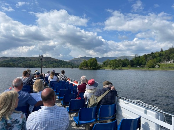
We had much bigger problems than a delayed meal. We had to get the whole group over the next hill and along the shore to catch what no-one was expecting – a small and little-known ferry to take us to Ambleside, via a triangular sailing to Brockhole, the National Park’s visitor centre on the opposite (eastern) shore.

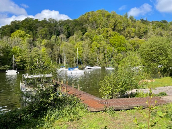
With a few minutes to spare, we rounded the headland and trudged, wearily, past the old boathouse and onto the pier. Within five minutes, the ferry came into view, beginning its wide arc round the bay to enter the small jetty space.


We had made it with a mere five minutes to spare… Our onward connections and the rest of the day were safe…

The trip to Brockholes is a matter of 15 minutes. Some passengers get off there to explore, but we sat comfortably enjoying the relaxation after the day’s exertions.
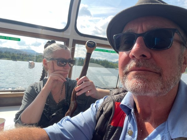
After Brockhole, with the sun still strong in the sky, the boat turned back towards Ambleside’s ferry point at Waterhead. Spirits had lifted with the refreshments, and the scenery was glorious. It was slowly dawning on the group that the day’s walking was finished; that we had, as stated, crossed over the head of the lake back to the east bank, but not by walking.
No-one was abusive…
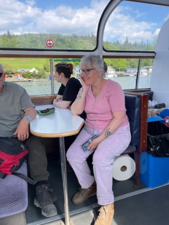
Arriving twenty minutes later in Waterhead, we needed to buy our tickets for Bowness – our final ferry crossing of the day. The cafe on Waterhead pier provided such delights as scones with jam and cream … and hot tea. A hasty snack later, we watched as the incoming ferry docked. We were in luck. It was one of the most luxurious boats of the fleet – the Swan. Our return leg to Bowness would be in style.
Surround yourself with beauty … and it will do the rest.
Ancient Sufi Wisdom
Everyone was quiet during the return journey. There was a happy mellowness about the late afternoon.
I had anticipated that we might need to cut out the visit to Wray. To compensate for the day’s meagre rations – thank heavens for Kendal Mint Cake – we had booked a table for dinner at the other end of the lake: The Swan at Newby Bridge.
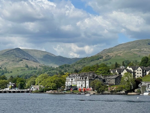
There was just time to walk from the ferry point at Bowness to Ferry Nab and collect the cars for the short drive to the southernmost point of Lake Windermere – Newby Bridge.

It has an excellent bistro. The rushing was over. We could take our time over a fine meal. No-one left in the least bit hungry….and everyone was smiling.
To be concluded in Part Six
This is Part Five
©Stephen Tanham 2023
Stephen Tanham is a Director of the Silent Eye, a journey through the forest of personality to the dawn of Being.
http://www.thesilenteye.co.uk and http://www.suningemini.blog
Share this:


The small village of Skelsmergh lies at the end of one of the long, twisty lanes that follow the valley of the River Mint and eventually merge onto the A6 trunk road: formerly the main highway across the Shap Summit to Penrith, then on to Carlisle and Scotland.
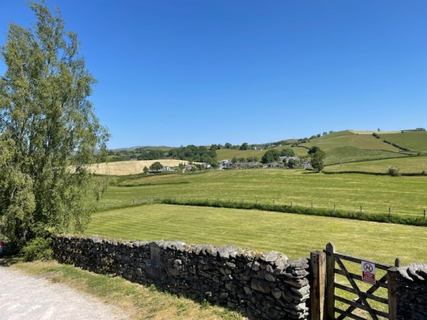
The M6 motorway reduced the A6’s critical role … but left it much less frantic for those whose concern is scenery over speed.
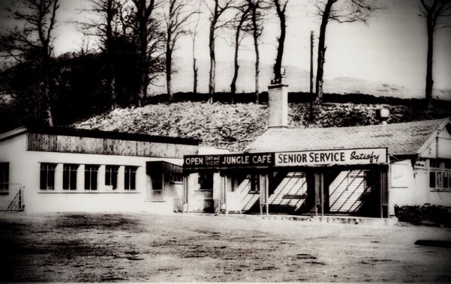
Skelsmergh lies on the town border of Kendal, forming a liminal space between the town and the wildness of Shap – famous for its alpine-like roads and long-gone transport cafés that provided emergency food and lodgings for lorry drivers trapped there in snowstorms.
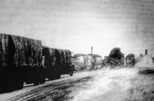
This is a fierce place in winter.
But not today. Fresh out of our Pilates class, I can linger and rest the camera on the roof of the car … and smile at the infinite green palette before us.
Summer shots are my favourite, but Skelsmergh can provide its own drama in the winter, too.
Note: the historic images of Shap are from the website trucknetuk.com and edited here by the author.
©Stephen Tanham 2023
Stephen Tanham is a Director of the Silent Eye, a journey through the forest of personality to the dawn of Being.
http://www.thesilenteye.co.uk and http://www.suningemini.blog
Share this:

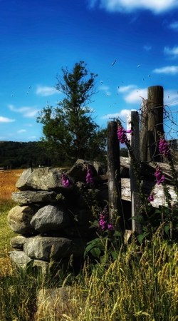
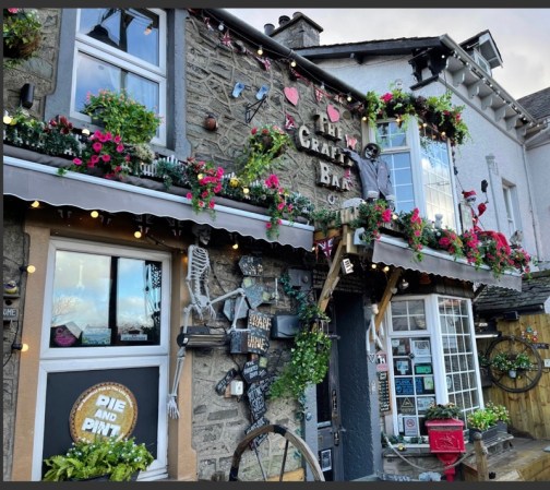
An early start; coffee and croissants in this lovely gem of a town, rich with West Yorkshire history.
A short visit to the local street market to buy strawberries, run them back to the car, then meet up for lunch with my son and his son – our grandson.
The heavens opened. The pavement stones gave off hints of steam as the rain pounded them. We made for the car at the other end of the town centre, laughing to be cool and wet instead of hot and breathless.
And there was the shot: right next to the car… An alignment of stone wall, retained flower bed with flowering shrubs, and a sky washed blue and pearl
It’s a lesson in not putting the camera away … too soon.
©Stephen Tanham 2023
Stephen Tanham is a Director of the Silent Eye, a journey through the forest of personality to the dawn of Being.
http://www.thesilenteye.co.uk and http://www.suningemini.blog
Share this:


+ #Silent Eye, #Silenti, Ancient Landscapes, Consciousness, Lake District, Photography, Silent Eye School
Water-Circle+Cross (4) in the realm of the sky-god
by Steve Tanham
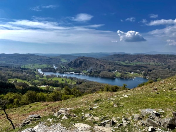
There is a feeling – as Lake Windermere falls away below – that you are leaving behind one realm and entering another – one dominated by a sky-god.
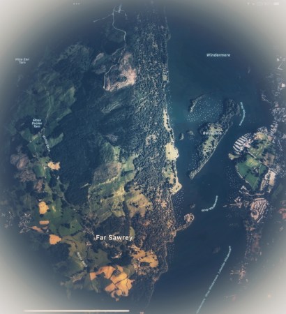
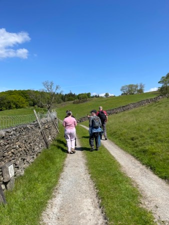
Within minutes we were climbing strongly, part way up the road that snakes over the hill and down to Hawkshead. Fed by the traffic from the chain-link ferry, it climbs steeply, twisting and turning its way through Far Sawrey: the once-home of Beatrice Potter, the famous children’s author and co-creator of the National Trust, much of whose original land she gifted from her own estate.

The Saturday morning of the Silent Eye’s 2023 ‘walking workshop’ – Circle-Water+Cross, was in ‘full-climb’ and began in glorious sunshine. We had opted for the road-based ascent because its gradient was less steep than the direct but tricky trail that winds up from the Claife Viewing Station We wanted to minimise the risks, and allow our muscles to bed-in for the long day’s walking.
The journey would take as high over Claife Heights, along most of the northern length of Lake Windermere and eventually down to a mystery destination on the shore, several miles north.


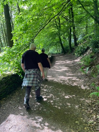
With a nod to Tolkien, we turned right at the Cuckoo Brow Inn, to gain access to the steep and stony track out of the village of Far Sawrey and, finally, up onto Claife Heights.
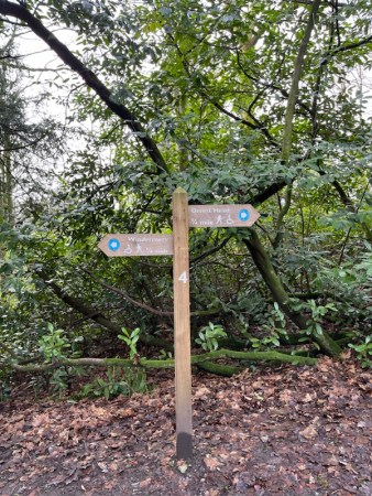
There are various pathways across Claife Heights – not everyone wants to stay close to the lake. Between them, and confusingly, they seem to share only four destinations: Hawkshead, Belle Grange, High Wray and Blelham Tarn. It makes a big difference to your day to pick the right one… But the signs indicate paths that sometimes cross-cross each other.
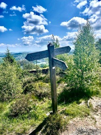
There is no substitute for knowing exactly where you’re going, and, as I found out on the day, that may take more than one preparatory visit! At least we now had the lake on the right to keep us straight. I knew the path we were on – thankfully not too muddy – would take us down to Belle Grange, from where it was under two miles to our mystery location by the lake.
We just had to keep an eye on the time…
On a previous walk, when Bernie and I were carrying out a final recce, we had struggled to cross a long muddy section that I now wanted to avoid. Unfortunately, at the next divergence of paths, I couldn’t locate the photo (on my phone) that I had taken as a guide of what not to do at this juncture.
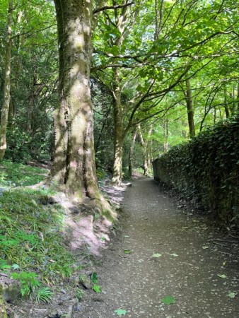
So we ended up right back in the (at least familiar) mud… Mercifully, the track had mainly dried out, and we passed through to the highest point on our walk without further difficulty. We’d been walking for about two hours at this point.
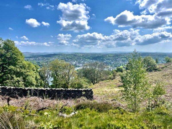
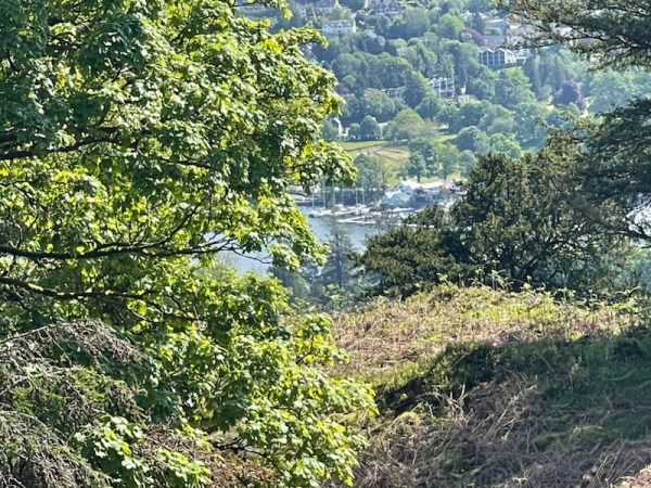
We had now worked our way back to the eastern edge of Claife Heights, and Lake Windermere was often visible through gaps in the trees. It’s reassuring to see familiar landmarks on the opposite shore. Our diversion up the Sawrey Road had costs us about 30 minutes, but we were making steady progress.
No-one else knew how far we had to travel. I had kept quiet about the final stages of the day’s journey…
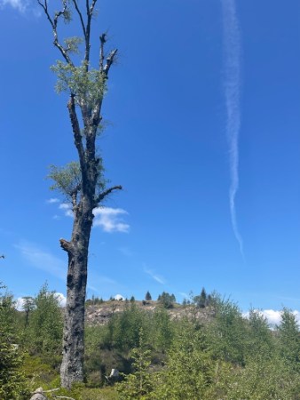
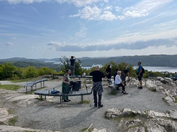
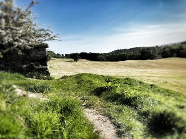
The final part of the climb is marked by a place we collectively called the ‘blasted heath’ – a desolate peak where everything seems to be dying – see photo above. In fact, the place is the subject of a programme to restock the heights with indigenous broad-leaf trees.

From here the path began to descend for the first time. After a few more minutes’ walk, we came across a recess beneath trees that was perfect for our late-morning stop.
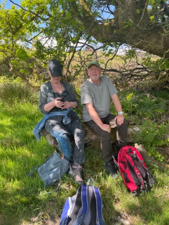
The essence of these outdoor weekends is spontaneity. We had an important task to perform – drinking tea from the giant flask I carry in my backpack for such occasions, and – for those I could persuade to do so – eating Kendal Mint Cake to keep our energy reserves up. It’s amazing what a bar of concentrated sugar can do for the spirits!
Humour aside, having exercised our legs and lungs, and now refreshed ourselves, we needed to shift our attention to the core of the workshop – the inner emotional state, and the power of this beautiful landscape to affect it.
Surround yourself with beauty … and it will do the rest.
Ancient Sufi Wisdom

We were taking two journeys. The outer one was to literally flood our sensual consciousness with beauty. In parallel with this was an inner, emotional journey involving the a kind of ‘sensual flowering’ of the centres in the belly, heart and head.
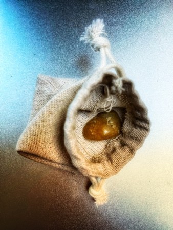
To assist with the focus, we had begun, on Friday afternoon, with each companion selecting a polished stone from a full bag, and associating that stone with the location and ‘feeling’ of the belly centre – located about three fingers below the navel and two-fingers into the body.
It was time to select an additional stone and associate it with the heart centre.

Collectively, we held the belly-centre focus and felt it ‘warming’; then allowed the restoring energy to rise in an organic shape so that its upper ‘branches’ surrounded the heart like a tree around the sky-picture of the sun.
It was only later that I realised our mental and emotional actions exactly mirrored the green, sheltered arbour in which we carried out the exercise.
We set off down the final stage of the descent to Belle Grange, on the lake shore, but one of the party had received a message from a long-standing friend of the Silent Eye – Barbara. She was having a struggle with a condition that required help and had asked that, since we were all together, could we consider sending some healing.
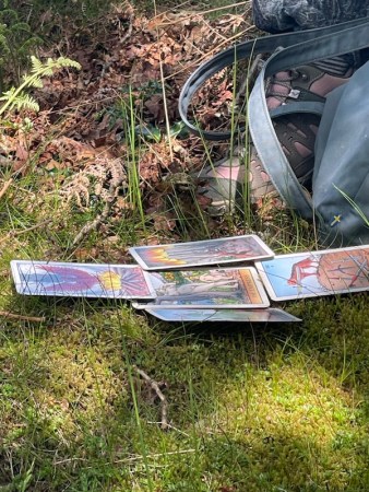
Briony, who is a trained shaman, offered to lead the group in diagnosing and then treating the condition. I will not divulge her methods, but she invoked her travelling tarot cards to ask the underlying nature of Barbara’s problem. This done, and joining hands, we set about visualising an energy response to this ‘diagnosis’.
Feeling recharged with the peaceful energy such endeavours bring, we set off along the remaining descent to Belle Grange.

The healing had cost us a further half-hour, but had been well worth it. But we now had problem. I no longer held out any hope of us completing the day as originally planned. Moreover, I had noticed that our pace was dropping. We were getting tired.
A drastic revision was needed if we were to avoid a most disappointing turn of events…
I held back, extracting some Kendal Mint Cake from my bag, and did some serious thinking as I weighed up what the group could best cope with…
A large marine clock was ticking.
To be continued in Part Five
This is Part Four
©Stephen Tanham 2023
Stephen Tanham is a Director of the Silent Eye, a journey through the forest of personality to the dawn of Being.
http://www.thesilenteye.co.uk and http://www.suningemini.blog
Share this:


Perhaps the loveliest we’ve ever seen. Any guesses where?


Post update 19:00 Tuesday 13 Jun. The location was Hampton Court Palace, next to the River Thames.
Several people guessed correctly, as per the comments. Well done and thank you for participating….
©Stephen Tanham 2023
Stephen Tanham is a Director of the Silent Eye, a journey through the forest of personality to the dawn of Being.
http://www.thesilenteye.co.uk and http://www.suningemini.blog
Share this:

+ #Silent Eye, #Silenti, Ancient Landscapes, Consciousness, Lake District, Photography, Silent Eye School
Water-Circle+Cross (3) Roof of the World
by Steve Tanham
**** Author’s note ***** For some obscure technical reason, this post failed to publish last week here on Sun in Gemini… and I’ve only just noticed. It did publish on the Silent Eye. For completeness, and ahead of the publication of the next part here on Thursday, I’m sending it to the printers, now!
The Saturday morning of the Silent Eye’s 2023 ‘walking workshop’ – Circle-Water+Cross, began in glorious sunshine. The photo below, taken the previous evening, had shown us – vividly – the first part of the ‘big day’s’ route – a south to north traverse of the ridge line of Claife Heights, coming down to rejoin the lake at a mysterious location as yet unknown to the companions.
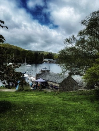
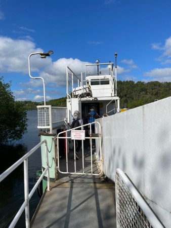
But first, as we had done on the day of arrival, we needed to cross Lake Windermere on the chain-link ferry. But today it would be a one-way journey.
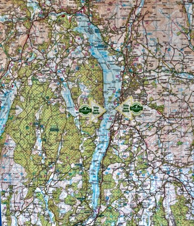
It’s worth considering the importance of the chain-link ferry to the region. Lake Windermere is England’s largest lake, at just over 10.5 miles long, and stretches from Newby Bridge in the south, to Waterhead, near Ambleside in the north.
The lake was formed in the ice age – more than 13,000 years ago, by two glaciers. One of these flowed from the giant ‘bowl” (Corrie) that is now the Fairfield Round. The other flowed from what is now the Troutbeck Valley and created what is now the southern half of the lake; the part that is south of the line of the ferry.
The Ferry Nab service runs across the shallowest part of the lake, the place where these two glacial formations met. The group of small islands scattered across the waters near Bowness are the remains of this glacial meeting place. The chain-link ferry from Ferry Nab links the narrowest points on the lake shore, and provides a uniquely short crossing for both vehicles and pedestrians.
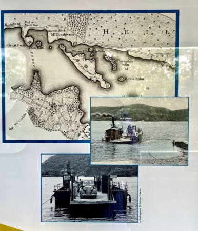
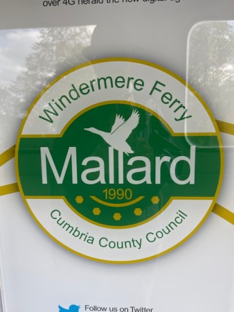
The first chain-link ferry, powered by steam, began operating in 1870. The route was immediately popular and bolstered by a new boat in 1915 and, later, in 1954, when the boat ‘Drake’ was introduced. The current ferry, named Mallard, was constructed in 1990. It can carry up to 18 cars and over 100 foot passengers.
After the short voyage we left the ferry behind. With some humour, we considered the last toilets for five miles – considerately placed at the ferry point. Not to take advantage of them would have been reminiscent of the famous death’s head caricatures saying ‘You’ll be sooooorry!” used in the Warner Bros, Road Runner and Wile E. Coyote cartoons…
We used them.

The whole day was constructed around a careful set of timings that two of us had worked on and tested in the few weeks prior to the event. For reasons that will become clear, it was critical that the group reached a certain point on the map by a certain time…
Despite this, there were certain risks to be taken. The first of these was that, for the camaraderie of the group, we needed another mug of coffee from Joey’s before beginning our ascent of Claife Heights to the ridge.
Such decisions may seem trivial, but they can alter the whole mood of the day… as anyone who’s organised a walking tour will tell you!
The other reason I wanted a coffee was to give time for us to reflect on a major decision. The previous day, one of our number had sustained a muscular sprain in one leg. He was strong and well-capable of judging his own ability to carry on, but, faced with the difficult assault on Claife Heights ahead of us, I wondered if we could smooth that process … and give him (and the rest of us) a gentler start to what was going to be a demanding day.
I sipped my coffee and considered the map…
To be continued in Part Four
This is Part Three
©Stephen Tanham 2023
Stephen Tanham is a Director of the Silent Eye, a journey through the forest of personality to the dawn of Being.
http://www.thesilenteye.co.uk and http://www.suningemini.blog
Share this:


©Stephen Tanham 2023
Stephen Tanham is a Director of the Silent Eye, a journey through the forest of personality to the dawn of Being.
http://www.thesilenteye.co.uk and http://www.suningemini.blog
Share this:

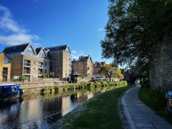
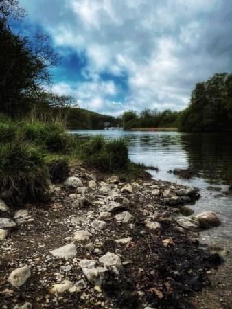
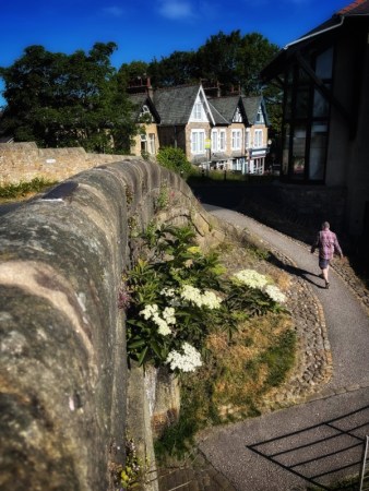
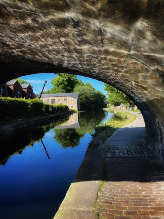
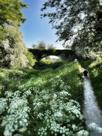
Just down from the extensive Royal Lancaster Infirmary (RLI), and passing under the busy A6 road from the south, there begins one of the most attractive sections of the old Lancaster Canal, as it leaves behind the gentle countryside of north Lancashire and enters the old industrial landscape of the former ‘county town’ from which the county name derives.
The House of Lancaster features prominently in English history, alongside its old rival the House of York. The historically-famous Wars of the Roses were fought between these great dynastic powers, though much of the action was in the south of England. Shakespeare’s ‘history plays’ are rich with references.
My wife had a routine appointment at the RLI hospital and we decided to make a morning of it, planning to stroll around the city centre in the beautiful May sunshine.
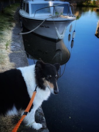
But first the dog needed her walk… I left Bernie at the hospital and we headed to the edge of the city. The old canal path offered an obvious route for a dog walk, taking in banks of grass as well as the hard standing of most of the track.
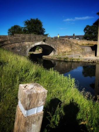
Though we had walked other sections – the canal stretches, lock-free from Preston to Tewitfield near Carnforth – I had never explored this part, which is local to the city centre in Lancaster. The beautiful day, full of May freshness, enabled an enchanting hour of strolling and letting Tess sample a million new sniffs…
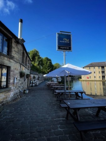
The Aldcliffe district of Lancaster now opens up on the right hand side of the opposite path. This follows the line of the canal down towards Glasson Dock – and the sea.
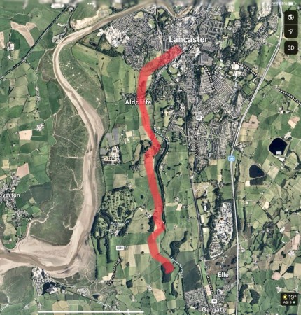
Beyond the Aldcliffe Bridge, the landscape ‘softens’ as it curls to follow the estuary of the River Lune.
We didn’t get much further. The phone rang. My wife’s appointment had finished early. Tess and I needed to turn round to rejoin her in the city centre.
On another occasion, I hope to continue this walk – and record it on a similarly perfect day.
©Stephen Tanham 2023
Stephen Tanham is a Director of the Silent Eye, a journey through the forest of personality to the dawn of Being.
http://www.thesilenteye.co.uk and http://www.suningemini.blog
Share this:

+ #Poetry, #Silenti, #wantonwhimsy, Consciousness, esoteric psychology, Love, Mystical poetry, Photography
One god of two
by Steve Tanham

One god of two, she chooses
From the young faces at the bar
While he, her husband?
To be or not…
Long, lean and known to her every wish
Smiles into his cigar
Did God post the envelope you open with your lips
In a reverse of time?
And the page within is blank
Save … now it says:
‘The page within is blank’
©Stephen Tanham 2023
Stephen Tanham is a Director of the Silent Eye, a journey through the forest of personality to the dawn of Being.
http://www.thesilenteye.co.uk and http://www.suningemini.blog
Share this:

+ #Silent Eye, #Silenti, Ancient Landscapes, Consciousness, Lake District, Photography, Silent Eye School
Water-Circle+Cross (2) “… a spell that changed my life.”
by Steve Tanham
In 1930, a 23 year old accountant from Blackburn arrived by train in the small town of Windermere, high above the lake that shares its name. He asked the way to the ancient path that climbed from the edge of the main road (what is now the busy A591) and, fastening his battered tweed jacket against the stiff breeze, strode up to the peak.
Less than an hour later, he stood on Orrest Head; well known to local farmers as a ‘sheep trod’, and familiar to fell-runners and lovers… but otherwise little celebrated.
He stayed until the fading light drove him down the mountain.
He was later to write:
“Those few hours on Orrest Head cast a spell that changed my life…“
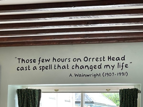
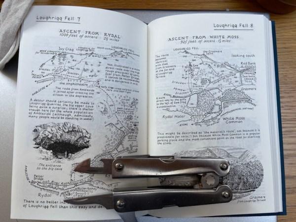
The man’s name was Alfred Wainwright. He was to become the celebrated chronicler of Lakeland’s footpaths and ‘high-ways’, increasing its popularity a hundredfold via his extensive series of hand-drawn manuscripts – text and all.
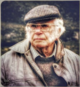
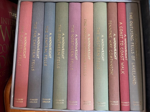
He would walk and photograph (in black and white) during the summer, then spend the winter writing up each page in faithful drawings and hand-written text.
And now our group had a chance to share the power of Wainwright’s moment on this most accessible of the high fells that overlook Lake Windermere.
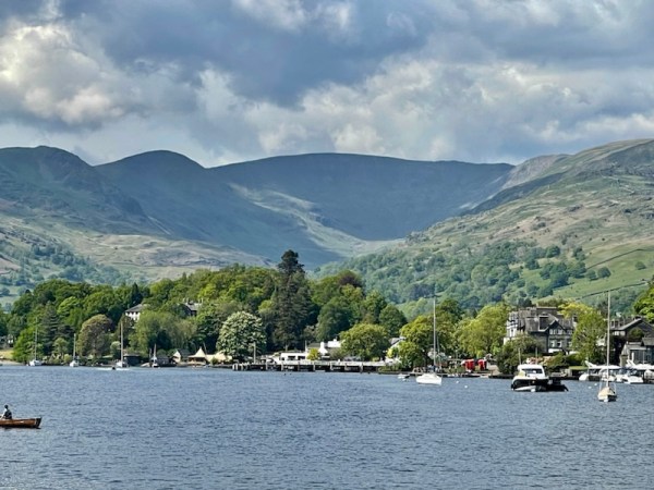
Earlier in the day, when the ferry had returned us from the Claife Viewing Platform, we drove in two of the cars up the hill to the town of Windermere; the place from which the lake takes its name, even though the water is a mile down the hill – under the alias of Bowness-on-Windermere. It causes confusion and we often need to point out the discrepancy along with the humour…
There, we walked through the pleasant streets in the afternoon sun. It’s often overlooked in favour of the more bustling neighbour – Bowness-on-Windermere, but is worthy of a visit in its own right.
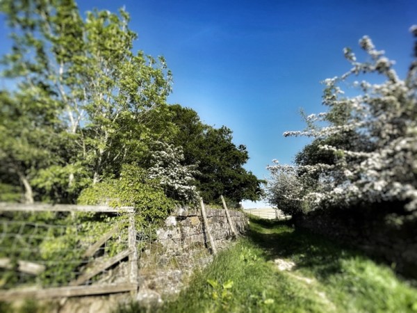
At the top of the town – literally – and crossing the busy A591, we entered a different world, by way of an access lane that provides a map of the ascent ahead.

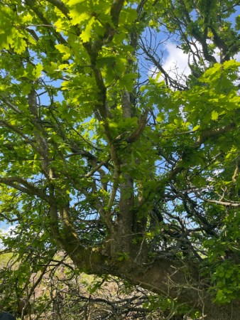
As soon as we began the climb, we once again marvelled at the ‘fresh’ green glory that is May in these parts. Sunshine is not guaranteed, but for the whole of our weekend, was in abundance.
For the Friday afternoon of these weekends, we are always conscious that people may have travelled a long way to join us. So each of the introductory activities needs to be short – compared with the main events of the Saturday to follow.

The walk up Orrest Head is through cooling forest paths, with a few short-cuts for those familiar with the terrain. The emergence onto the plateau at the peak is spectacular, and, as guide, you see everyone turning around in wonder at the height achieved in such a short time.

In truth, the car does most of the work. The small town of Windermere, itself, sits high above the lake, which is why the railway station is located here, and the line can go no further down what would be a steep gradient.

“Surround yourself with beauty and the rest will happen’
We had chosen this aphorism as a spoken ‘call’ to gather the Companions in order to switch our focus from landscape explorers to explorers of our inner natures. There was no doubting the beauty around us; now it was time to let nature’s restoration of our energies help us with a process of emotional self-discovery – the focus of the Water-Circle+Cross weekend.

In the upper level of the Claife Viewing station, we had given everyone an empty cotton bag, and invited them to take (blind) a polished stone from a larger ‘mother’ bag.
There are many approaches to the discovery and refinement of the energy flows in our bodies. We can speak of chakras, psychic centres or just ‘centres’ themselves. Faster progress can often be made by simplifying this ‘map’ into three: Belly, Heart and Head.
Day One of our workshop was all about ‘Belly’, the place that is both access point and governor of the turgid energies that rise from the physical earth and up into our limbs, concentrating their presence at the sacral and sexual locations in the body, ready for use when directed by the higher centres…or not.
Understanding these energies is important to the development of the ‘higher emotions’.
Over the weekend, three stones were to be selected; one for each day. These were picked ‘blind’ from the mother bag and placed into our own small pouches.
Now, high on Orrest Head, we performed a short exercise to link the first of these stones with our belly centre; linked in such a way that we had only to hold the stone to feel a warmth and resonance in the bodily locus. The exercise also directed us to keep a mental and emotional ‘hold’ on both stone and its centre as we descended from the beauty of the peak.
In this way, the energy of the day remained with us as though ‘distilled’ by our efforts.
We descended in relative silence. Each person rich with the day’s golden sun and the infusion of emotional energies reaching up from the belly in the form of a spiritual ‘rising love’. Its further journey would begin on the following morning, at the start of the Saturday – the day of the greatest adventure, during which a lot would be asked of the group – and even more would be returned by the sheer beauty of what we were to experience.

As I took my leave of the peak at Orrest Head, I looked across Lake Windermere to the long ridge that spanned most of the length of its western shore. It was named Claife Heights, and I proffered it a heartfelt wish that the Saturday should go well, and that we would find ourselves, successfully, on an unexpected shore at the close of the day…
Balance is important…vitally important. We were in need of a good ‘earthy evening’ to centre us and let us come down from the internal heights. We had selected a pub in Windermere town that had a ‘wacky’ reputation… and an excellent selection of wines and local ales. Drivers aside, the rest of the Companions sampled the wares with lots of fun. We all returned to our homes, hotels or guest-houses smiling and not too much the worse for wear.

My car will seat five, so I did most of the shuttling and little of the drinking, taking my enjoyment from the satisfied smiles on the faces of all present, before driving home to Kendal.
It had gone well. But we had only just started…
To be continued in Part Three
This is Part Two
Amazon link to the complete Wainwright Guides.
Guardian article on the return of the books to local publishing in Lakeland.
©Stephen Tanham 2023
Stephen Tanham is a Director of the Silent Eye, a journey through the forest of personality to the dawn of Being.
http://www.thesilenteye.co.uk and http://www.suningemini.blog
Share this:

+ #Phoetry, #Poetry, #Silenti, Ancient Landscapes, Collie dogs, Consciousness, English Lake District, guided mystical walks, landscapes, Mindfulness, Photography
Wander Wood #phoetry
by Steve Tanham
And is there time in wander wood
Or slow, abiding, gentle ‘should’
Without resistance: touch and kiss
A reaching for midsummer’s bliss
So powerful this May surprise
I need not leave my seat – just close my eyes
To wander in the wonder wood
©Stephen Tanham 2023
Stephen Tanham is a Director of the Silent Eye, a journey through the forest of personality to the dawn of Being.
http://www.thesilenteye.co.uk and http://www.suningemini.blog


")


You must be logged in to post a comment.